
Day 7 – Tokotee Falls


Tokotee Falls would prove both difficult to access (AWD was a must getting even close to the trailhead, and then 4WD if you wanted to drive all the way in) and difficult to find our way to the bottom of. However, the road getting there was perhaps one of the most beautiful and fun that I have come across – North Bank Road, particularly. Featuring sweeping bends and curves, it was a smile inducing drive that I wish I could do again (see the route below). There are some worthwhile stops along the way as well – check out roadtrippers.com if you’d like to make more of an adventure out of the winding road.
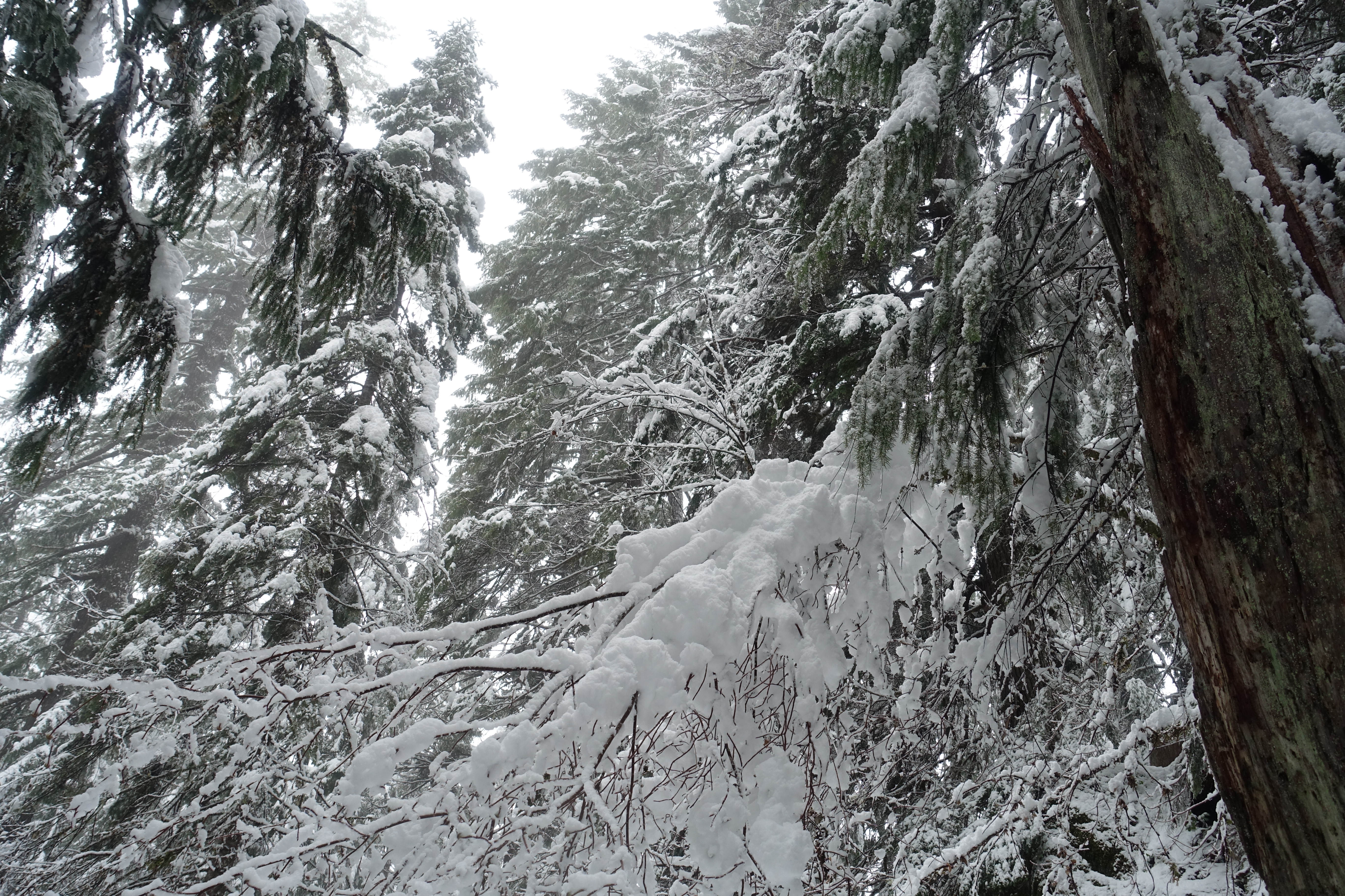
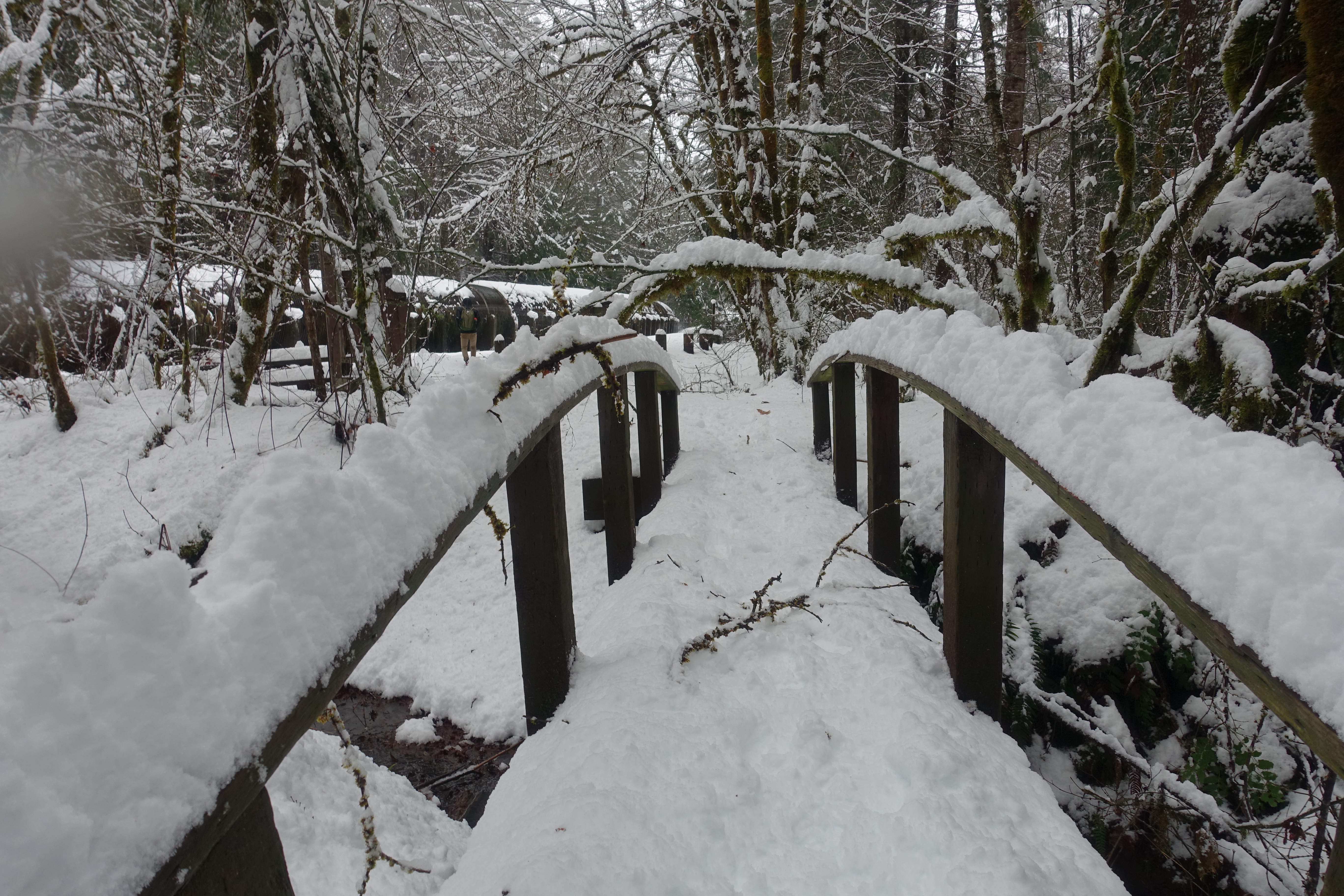
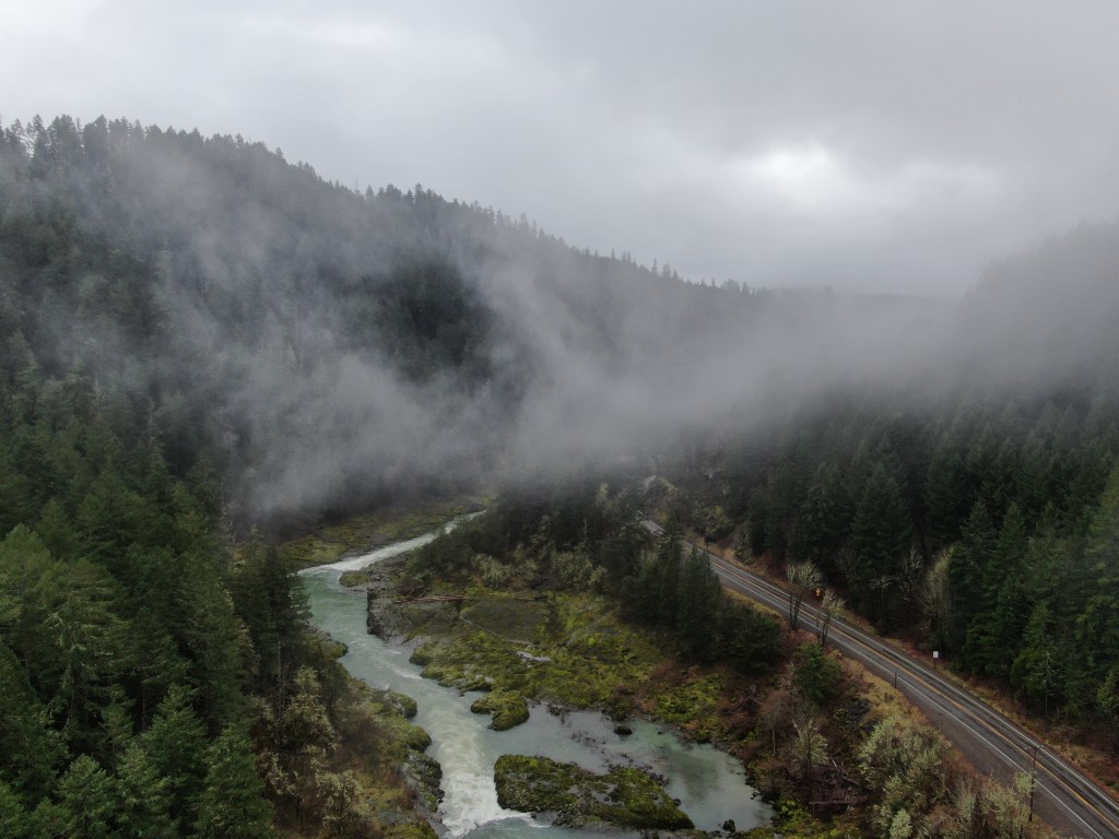
After waiting for the snowplow driver to clear a section for us to park, we crossed the bridge and the last half mile to the trailhead (trudging through about 6 inches of snow) and began the hike.


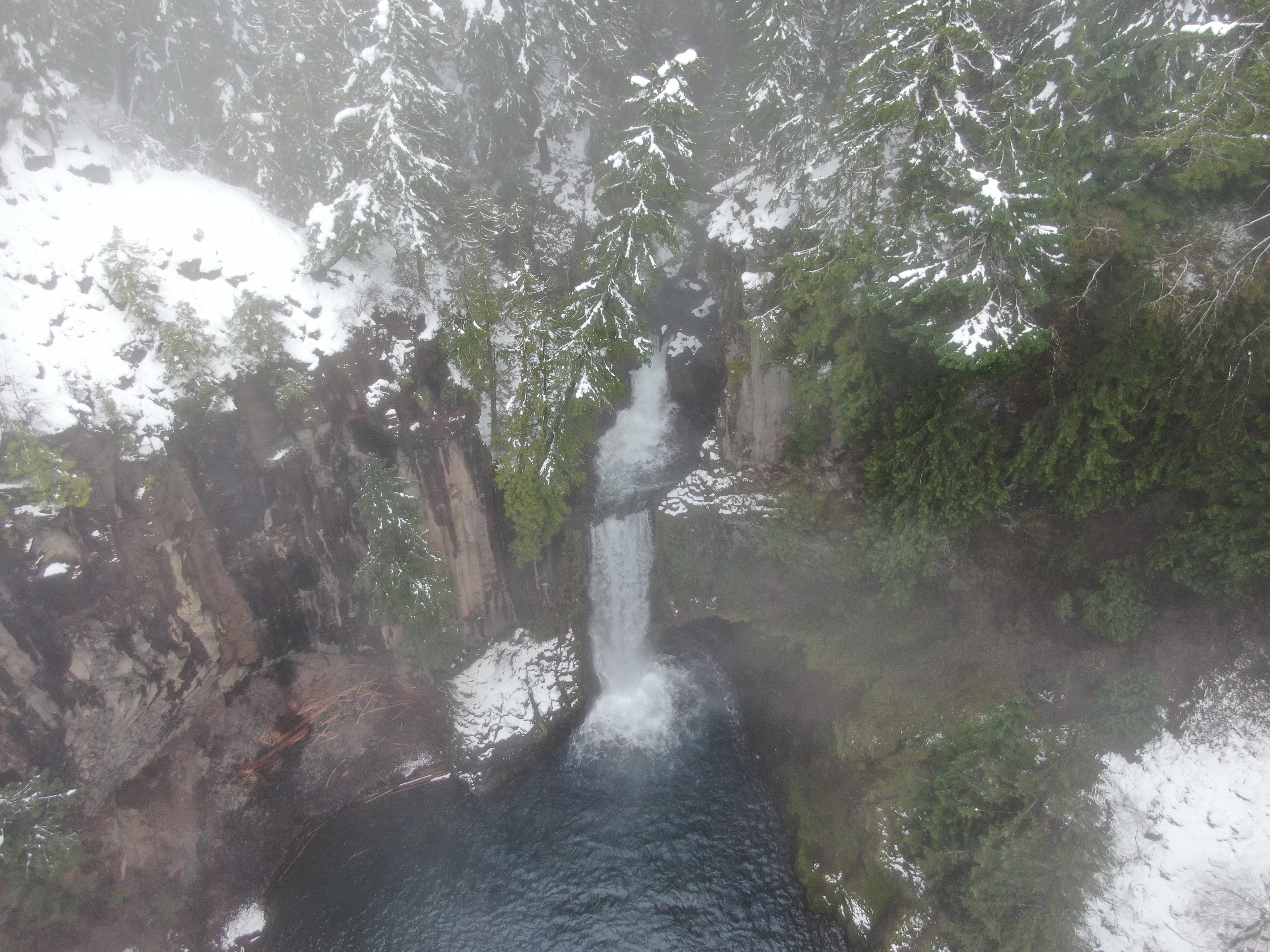
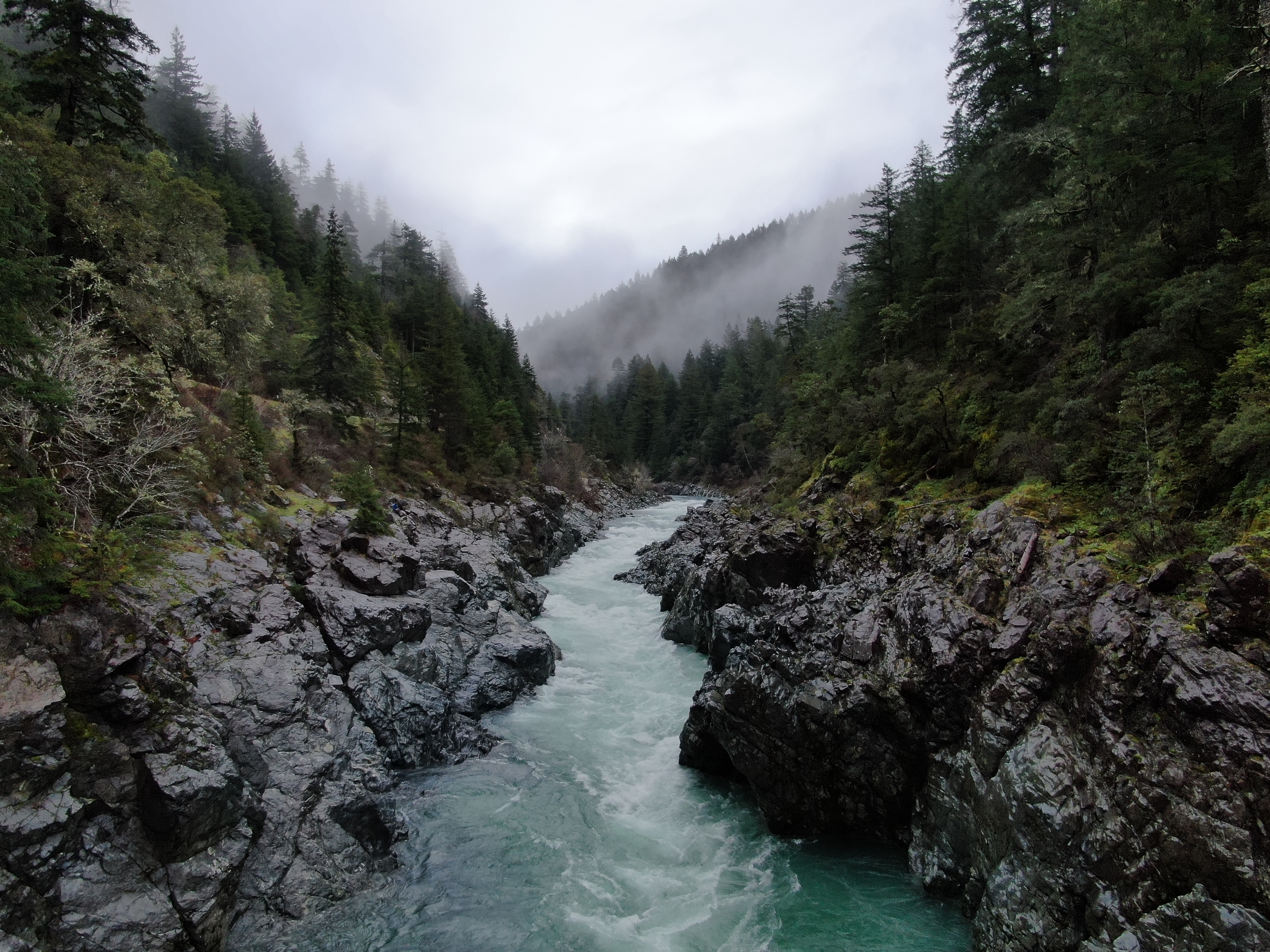
Microspikes or snowshoes were a must, as the heavy accumulation once you were in the forest and around the falls made for some slippery terrain. While the trail was relatively short to get to the falls viewing platform, the deep snow made it quickly tiresome and more of a workout than the distance would suggest. The viewing platform sits a few hundred feet in front of the falls and off to the left, with a good view down into the upper and lower falls and basin of the pool beneath.


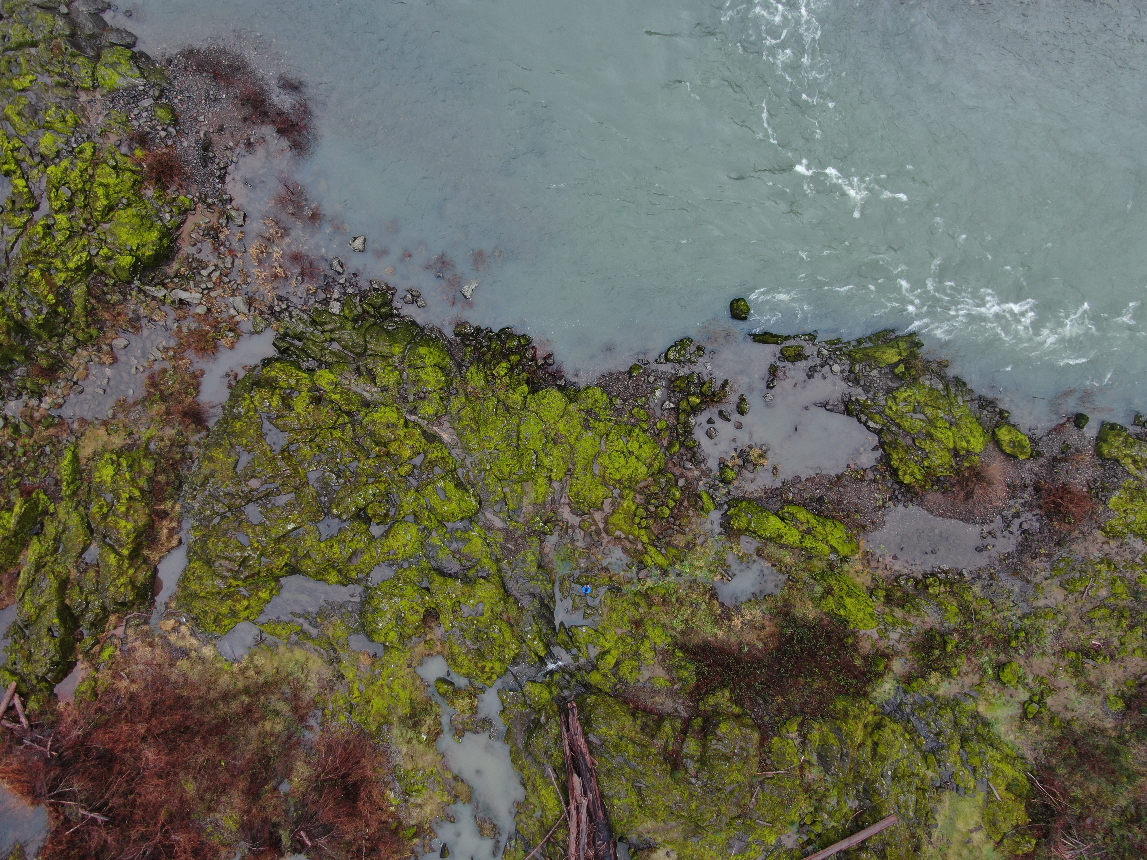
The problem (or dilemma perhaps) that we faced was that the best picture spot is arguably from the base of the falls, looking straight into the two pools and the rock gateways on either side. However – even in a summertime setting, the trail to get down there is poorly marked (if anything at all), and can require some creative scrambling. This was only magnified by the snow cover, which made it difficult to find a safe route or know what was underneath – there were even some sections that went over crevasses that were partially hidden.


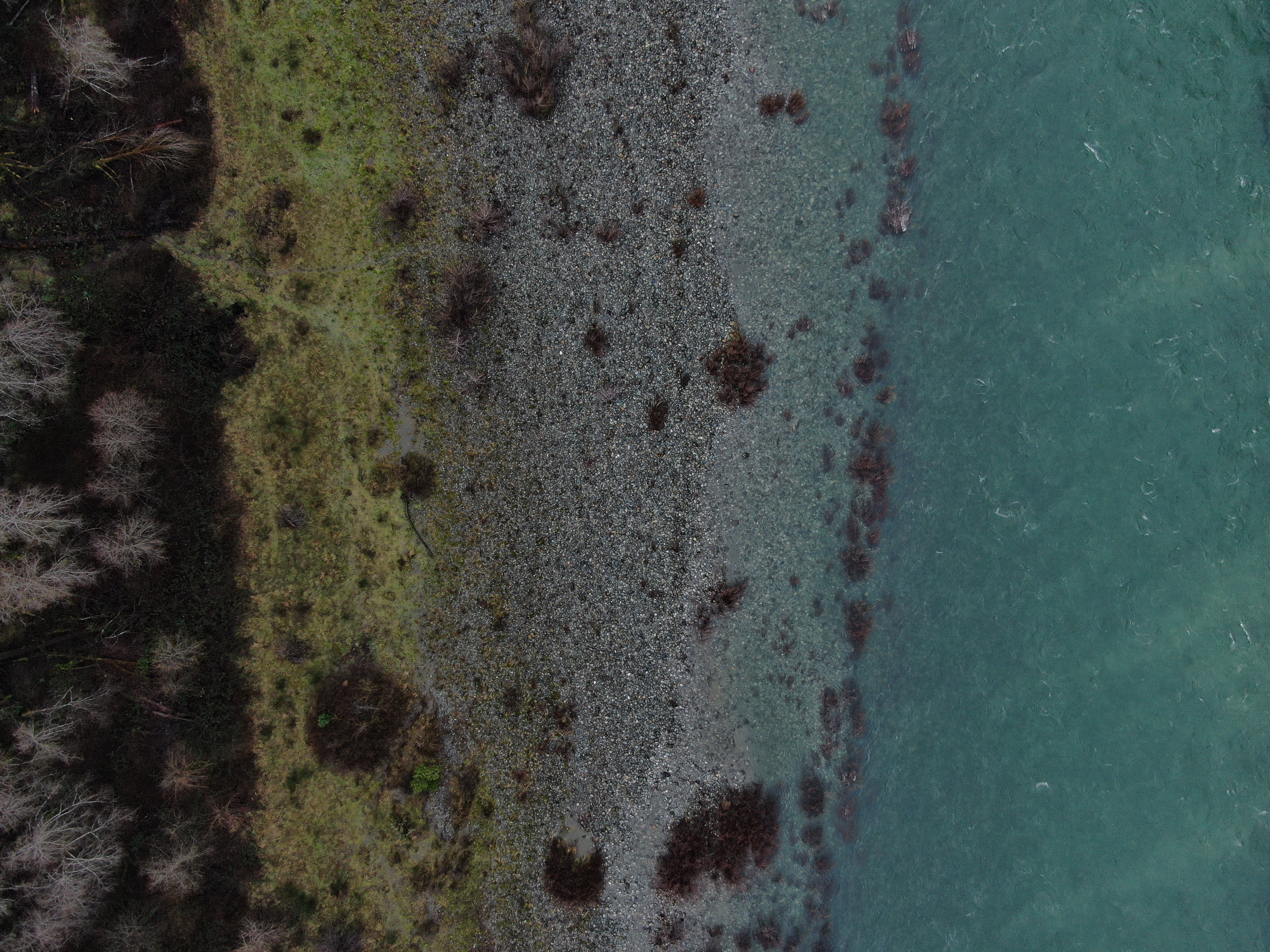
My travel partner made an attempt to get down to a lower level alone, and ended up getting himself stuck and a little cut up after a slide down the hill, and thats when I heard a shout for help. He wasn’t a particularly skilled hiker, nor knew much about hiking in winter. More interested in getting the ‘insta shot’ – he put himself into a dangerous situation, and quickly learned his lesson. Luckily, I had recently started carrying hammock straps at all times in my pack – and that day, the 30 feet of assistance that they provided was crucial. I was able to secure it around one of the viewpoint’s braces and provide a secure way out for said travel partner. Had I not been there, or been prepared with an improvised rope system, a call to the rangers might have been necessary. Below, you can see the pictures when I went down to safely investigate the path.


Needless to say, if you’re thinking of visiting Tokotee Falls in the winter, I wouldn’t recommend trying to find your way to the bottom unless you have hired an experienced guide who is familiar with the terrain. Let alone, attempting without having any winter hiking experience or equipment. Having had enough adventure for one day, we packed up and headed out from there after a few moments of rest at the viewpoint.
Heading back to Roseburg from Tokotee Falls, we stopped at a viewpoint along the North Umpqua River, where a glimpse of bright green moss caught my eye from the roadway. The tributary of the larger Umpqua River, running from the base of the cascades, had opalescent waters and would have made for a great spot to relax next to for a few hours on a warmer day.

Getting back to the AirBnB in Roseburg, I was especially looking forward to a quiet place to relax after the events earlier in the day. However, we were quickly greeted by two hosts who seemed to be very firm believers in the existence of Bigfoot – one even ran tours looking to find him (or her I guess). On top of that, there were children and pets there – and it just didn’t feel like the right place. My travel partner had been sick the last few days as well – and all of that combined made me quickly find another place to stay that night. While I had to spend an additional $90, it felt worth it for the needed R&R on a long trip.
Day 8 – Upper Table Rock
After leaving Roseburg, we headed to a rather interesting geological spot near White City, Oregon. The Table Rock formations are two volcanic plateaus that were formed about 7 million years ago and rise about 800 feet above the surrounding Rogue Valley. The easy/moderate trail to the top is about 1.6 miles each way, and winds through an impressive array of trees, shrubs, lichens, and when in bloom – wildflowers.
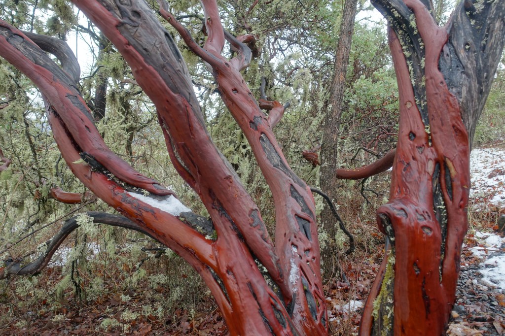


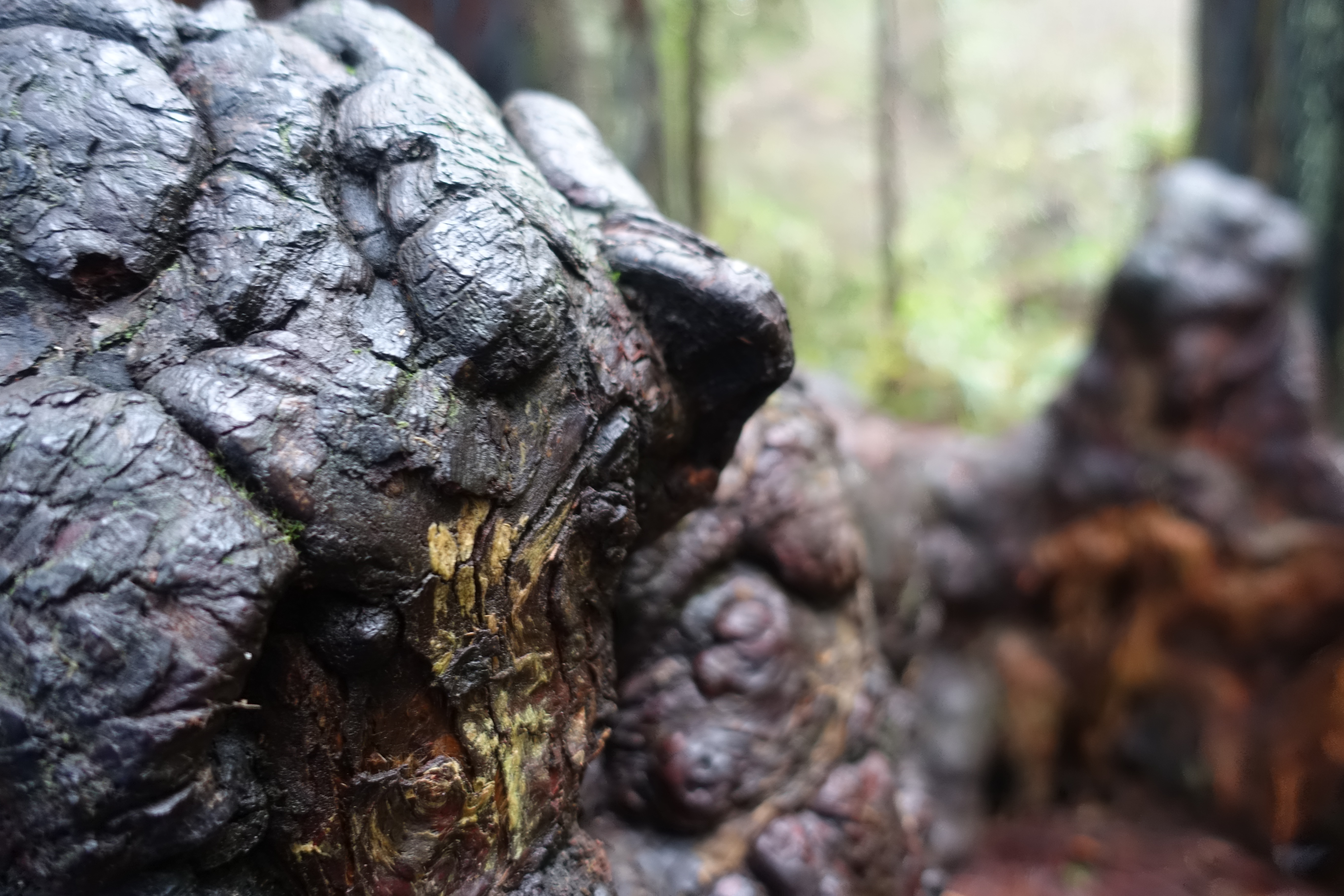
My favorite part of the hike was probably the Manzanita Trees, colloquially known as ‘Driftwood of the Mountains’ due to its smooth and twisted bark. The bright reds and oranges of the bark created a web like system of branches in the walkways, and the fine grain and unique texture of the wood was fascinating to look at up close and photograph. There were even spots where branches and stems had split open, and mosses had taken root at the exposed wood beneath – a vivid example of how you can find ‘art in nature’.


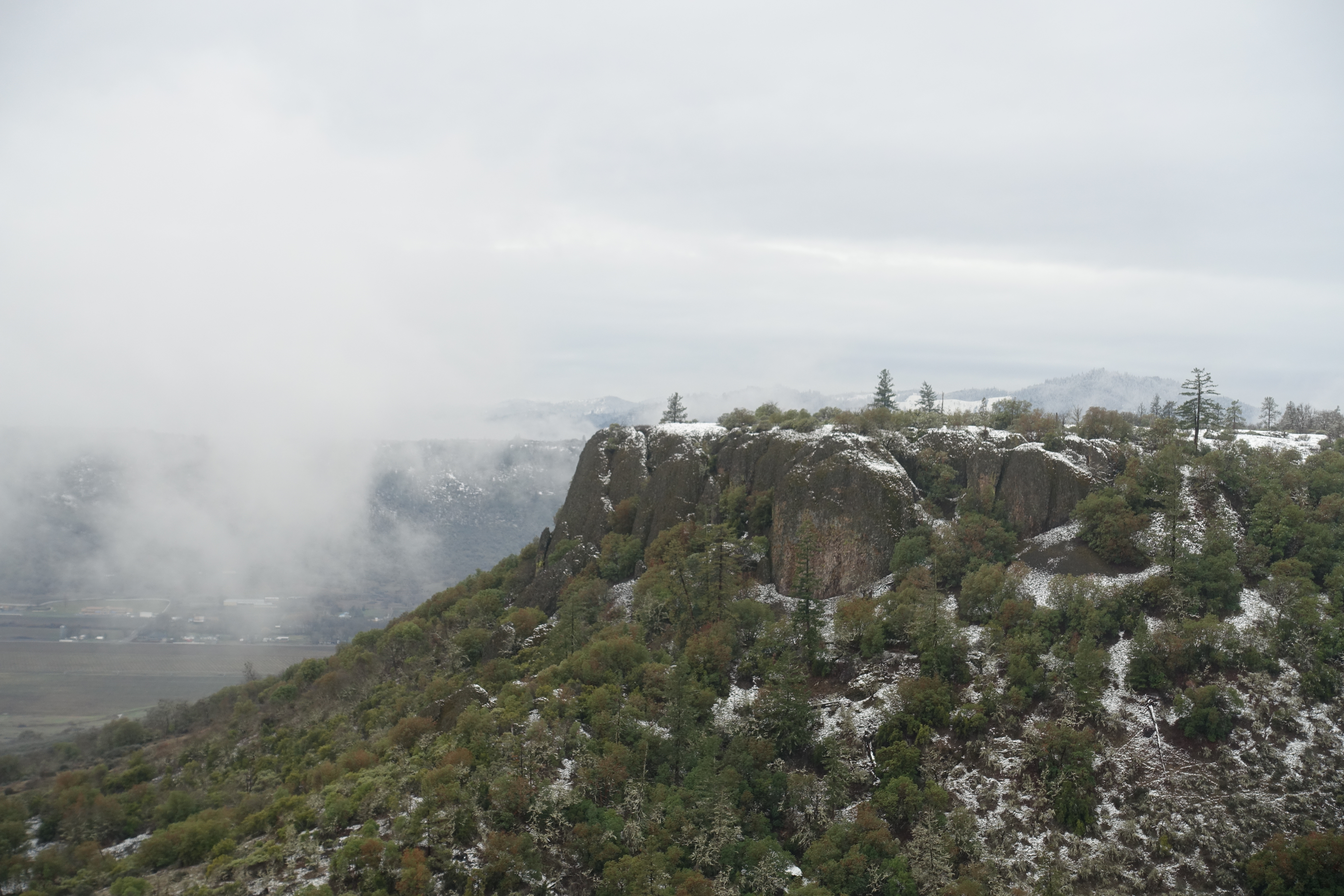

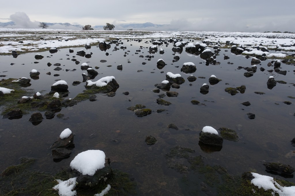
Just past there, you’ll come out onto the vast plateau that gives you 360 views (if you walk the perimeter of course) of the valley below, with some interesting rock formations creating an interesting foreground for photographs. One thing to be aware of is how muddy the trail can be in winter/spring and after a summer rain – it was a bit of ironically playing ‘the floor is lava’ as we skipped from rock to rock doing our best to avoid stepping into deep mud. It was a tranquil day after the excitement of Tokotee Falls, despite Table Rock being one of the ‘busier’ trails of the trip – ad by that, I mean about 8-10 other hikers. This park sees about 45,000 visitors annually, so it seems this ones’ crowds are more evenly spread out throughout the year.

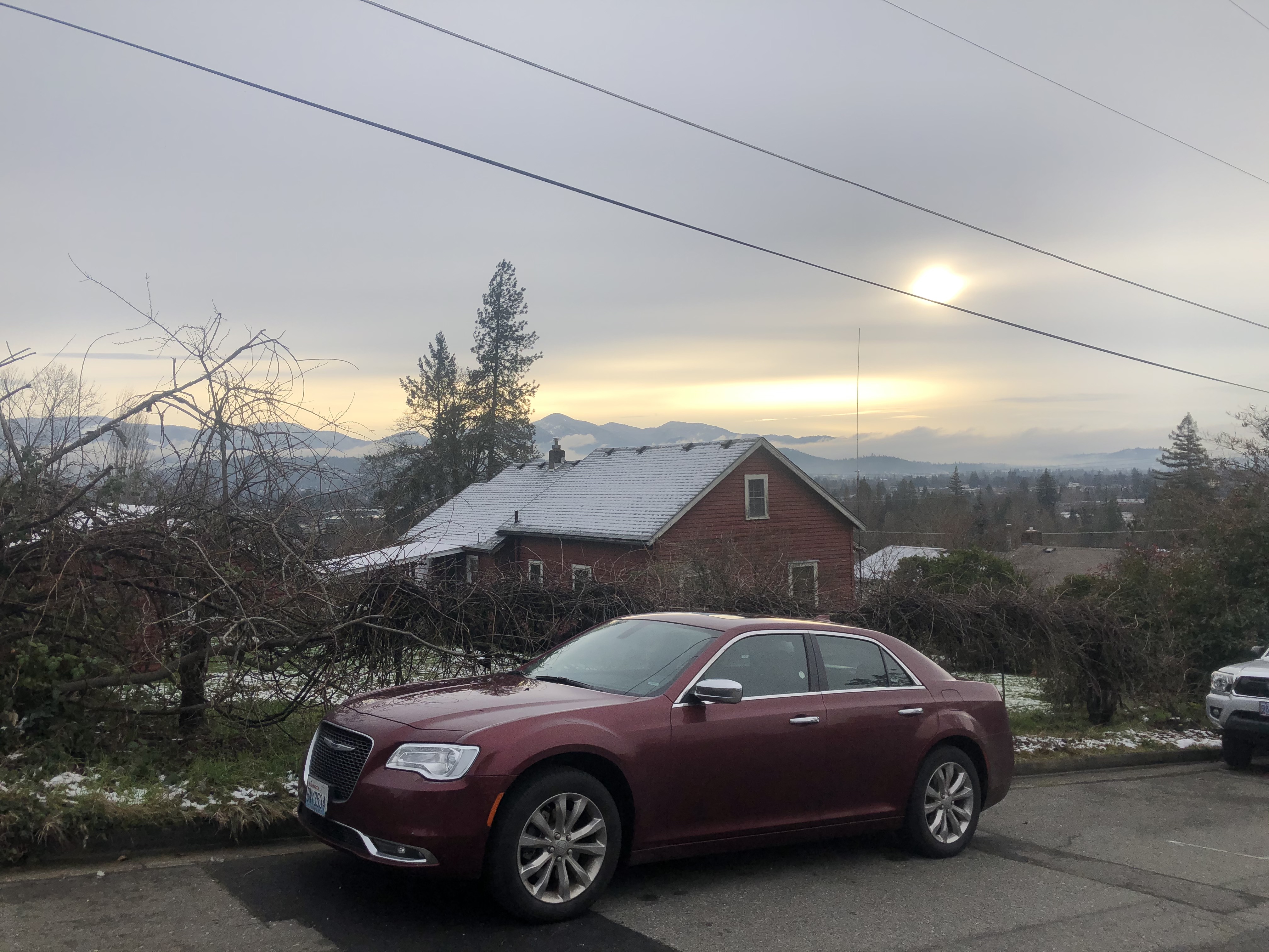
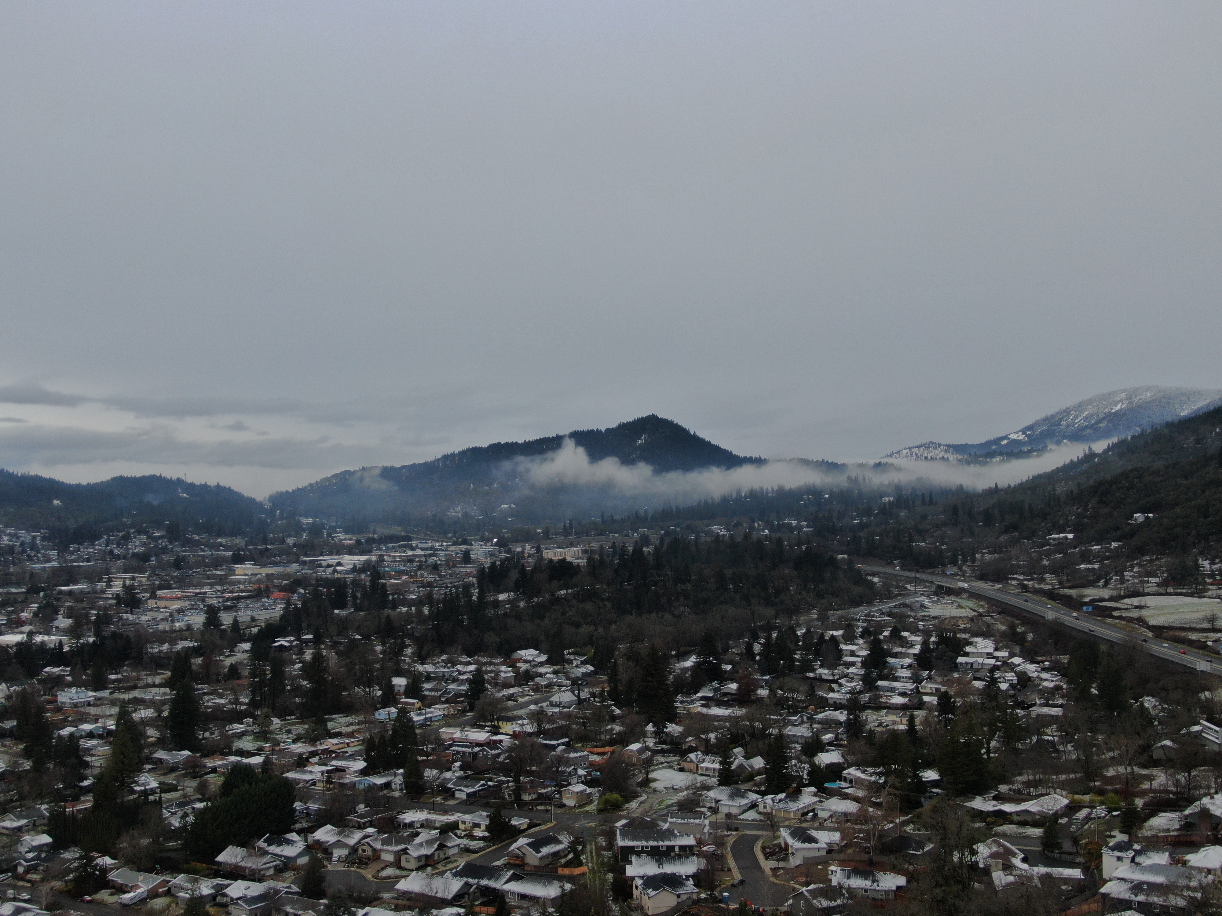
We spent the night in the nearby Grants Pass, where we were treated to a great sunset and beautiful views of the valley and town below, as our AirBnB was perched up on a hill towards the outer edges of town. I happened to have family living in nearby Medford, and was able to meet up with them for a quick dinner – one of my favorite parts of my travels have been getting to see family members I wouldn’t be around otherwise.
Day 9 – Redwoods and Down to California

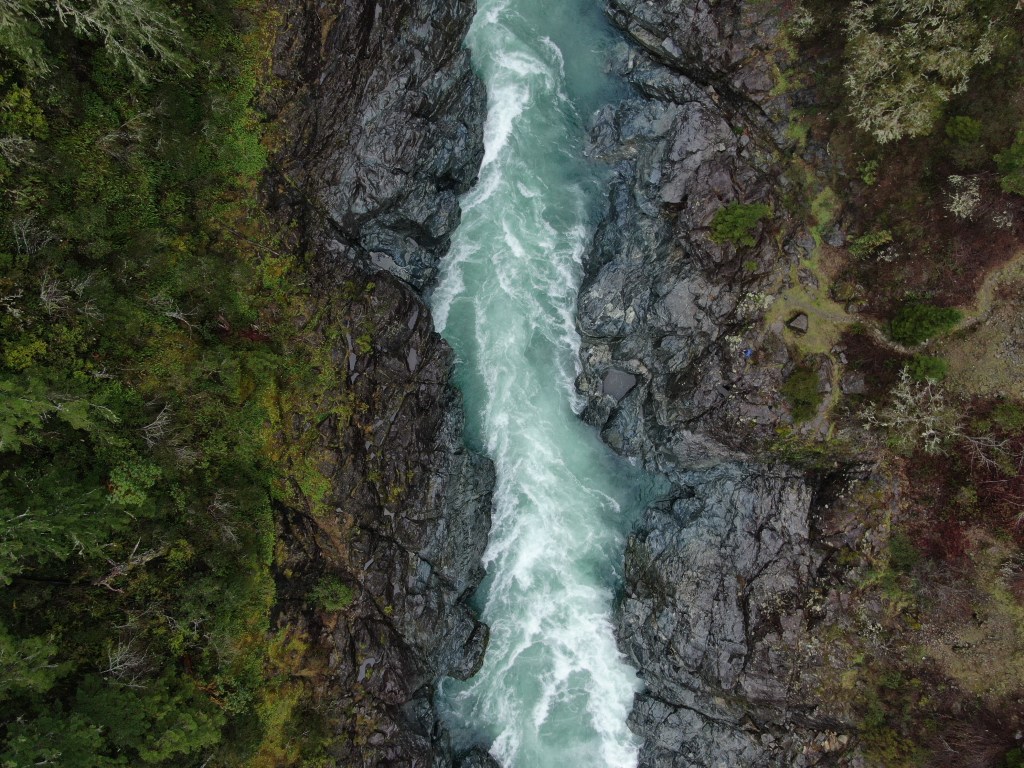
But wait – isn’t this an Oregon road trip? Well, yes – but since we were so tantalizingly close to California’s redwood state forest – we figured why not. We would also spend the next two nights in Crescent City, California, as it was the closest decent city to Brookings, Oregon (which would be the highlight of the trip for me). We set out driving towards the Jedediah Smith State Forest, and traced the route along the turquoise waters of the Smith River. which originates in Oregon, but mostly flows in California. We found a quick pull-off to get some shots of the river and bask in its unique ambiance before continuing on to the forest.


Even though I could have spent an afternoon chilling along those blue-green waters (and I highly suggest doing so if you have time the time), we continued on towards the Jedediah Smith Redwoods after crossing over the border into Northern California. The road getting up to the trailhead – Boy Scout Grove – was a little bumpy and pothole ridden (on top of some muddy spots), so be careful if you are driving a car with low clearance or particularly fancy wheels. This is where a 4Runner would have shined – alas, we made it through just fine in the Chrysler 300.

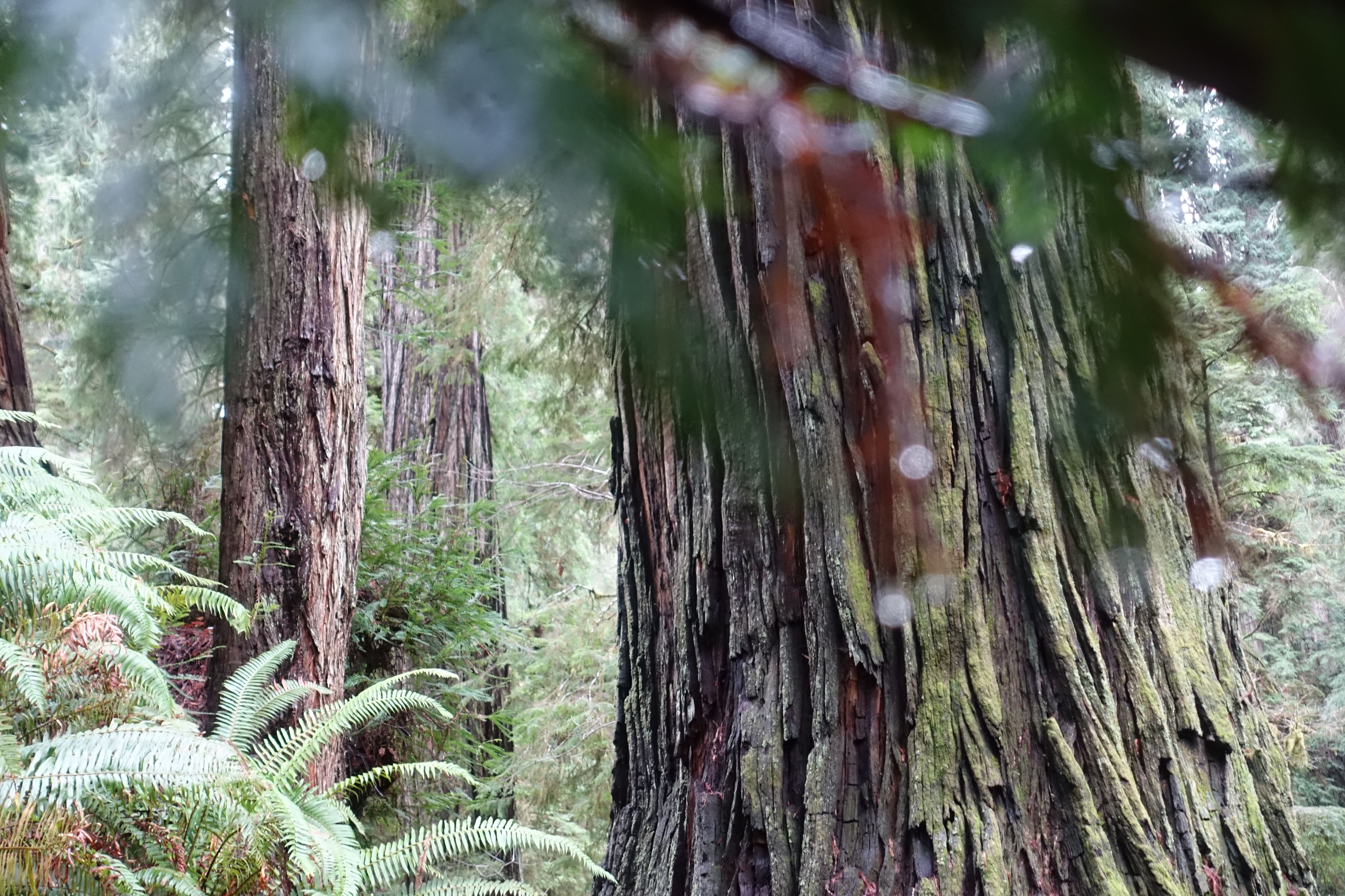

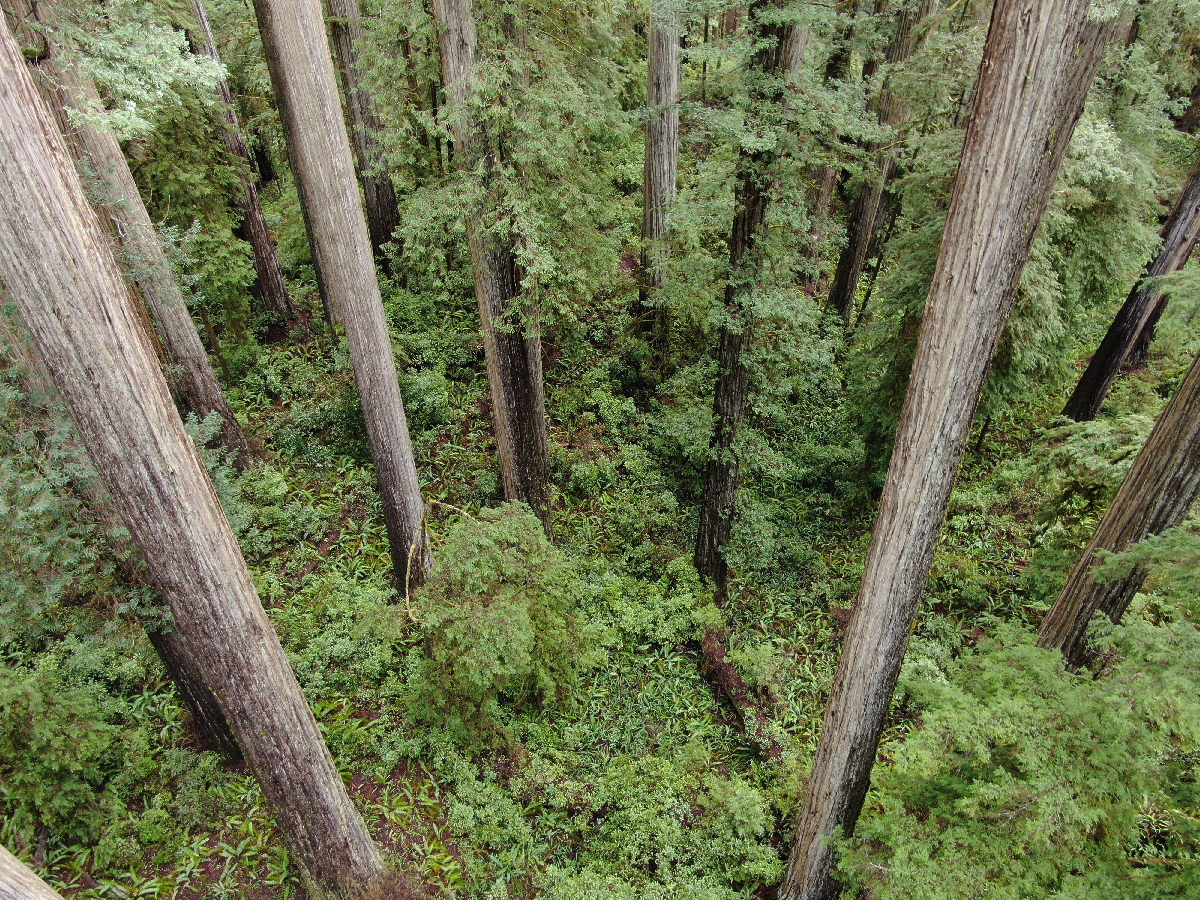
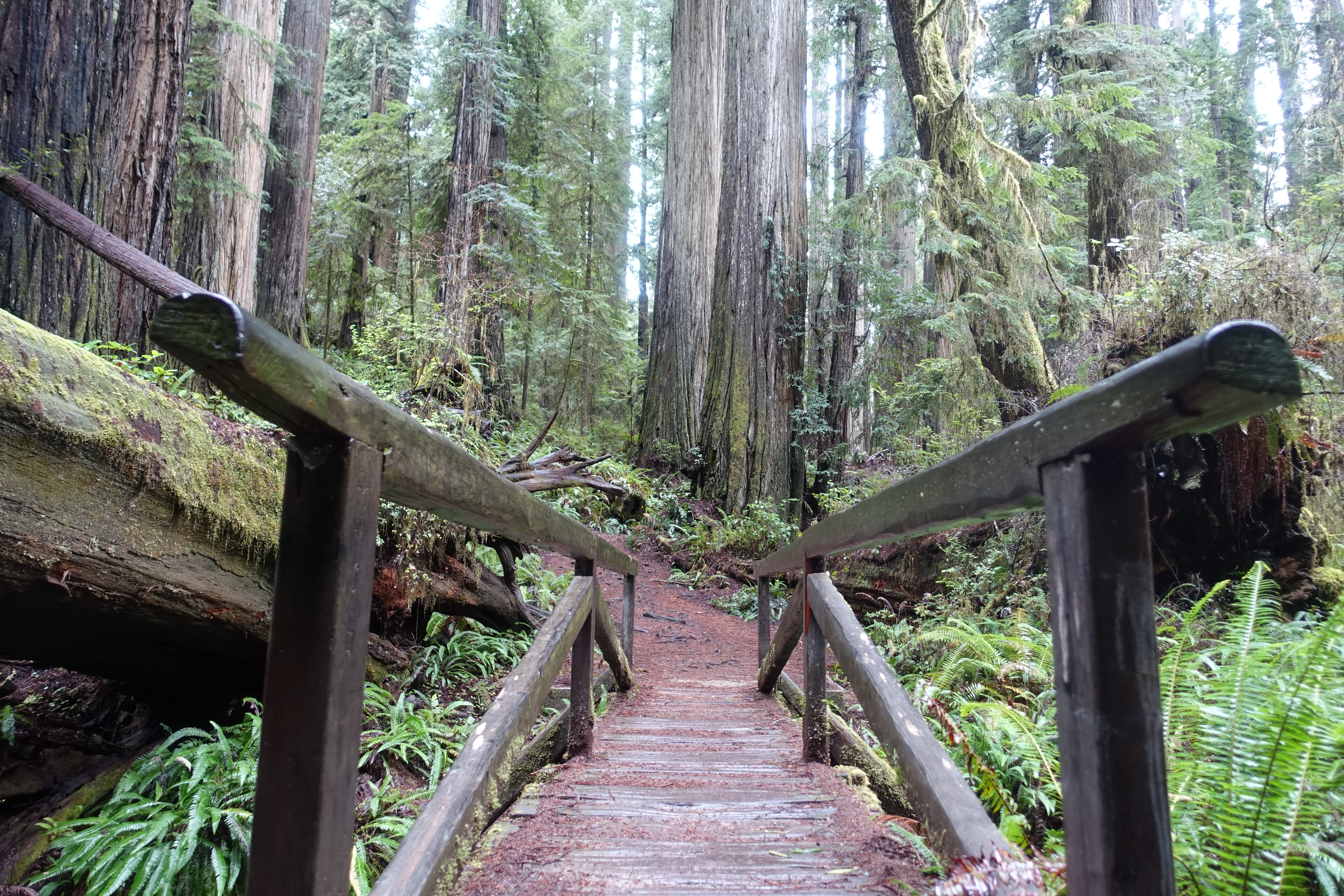
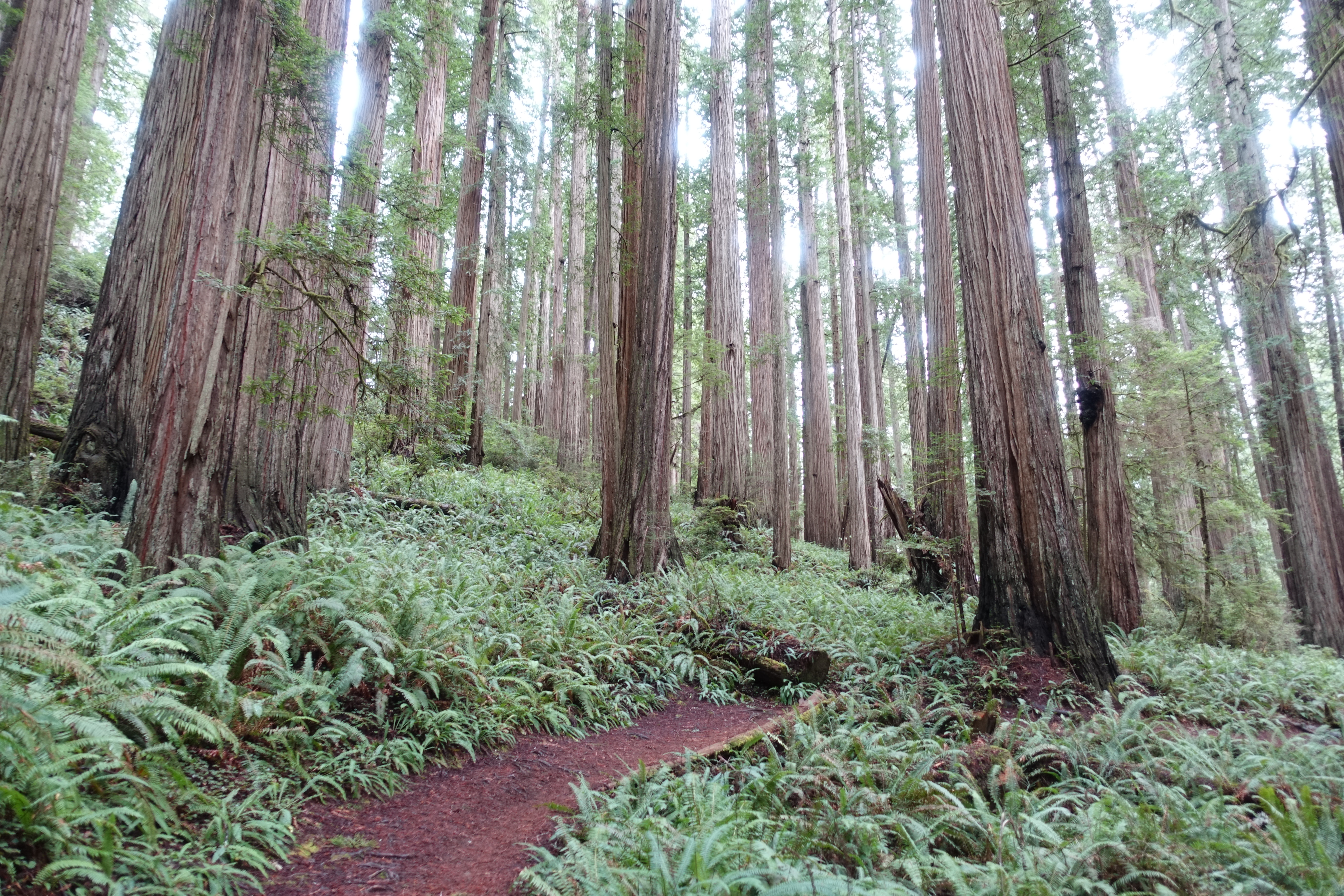
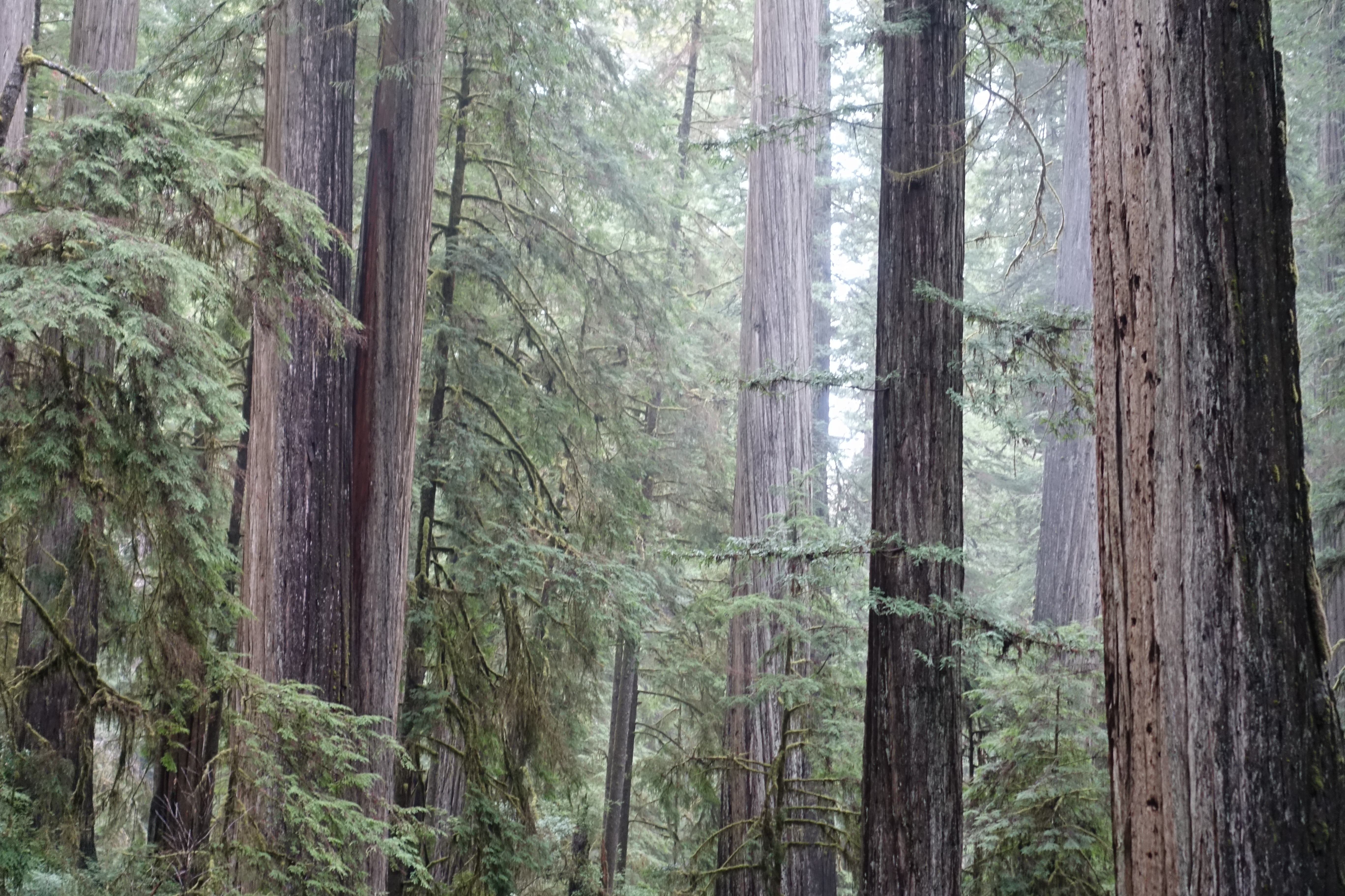
Once inside the towering forest, you’ll find yourself walking among the giants and the elders – many of the trees reach close to and over 200 feet tall – with the famous Boy Scout Tree reaching a truly impressive 238 feet tall. The redwood forest is so incredibly lush, that no matter where you look, you’re seeing an abundance of life. Between the ferns, mosses, mushrooms and of course the trees – its a nature photographer’s paradise. The trail takes you on about a 3-4 mile round trip through the forest as you get to the Boy Scout Tree – a great place to stop for a bite to eat and get reminder of just how small we are. There is also a small waterfall farther down the trail. but I chose to spend some additional time in the trees instead.
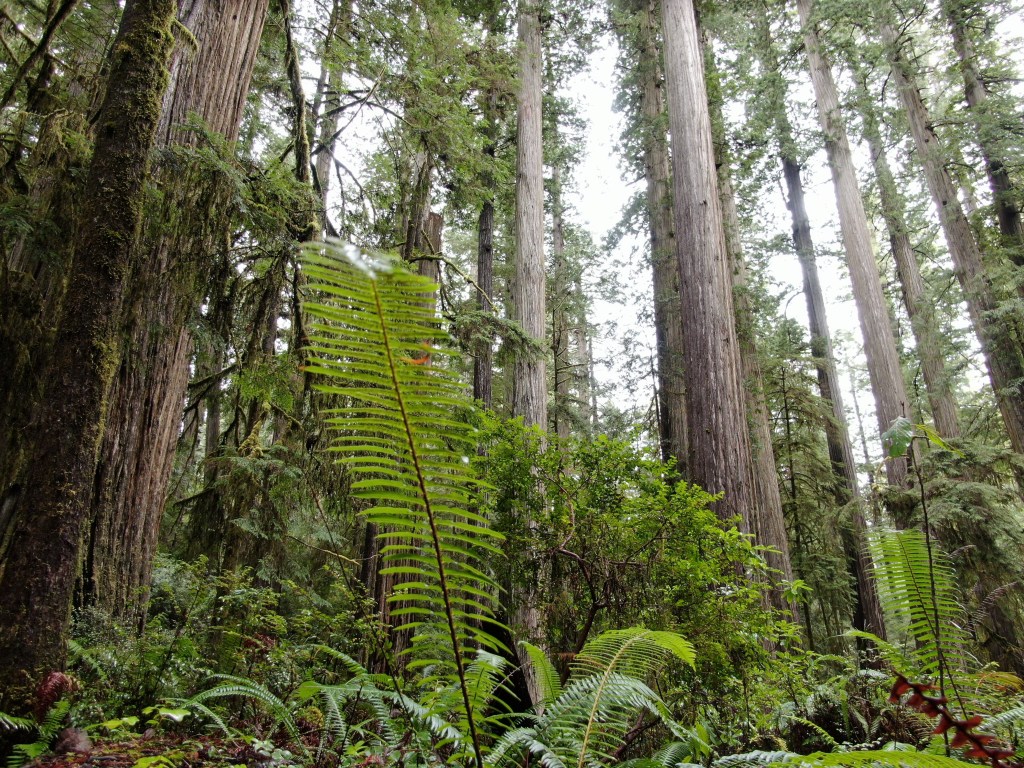


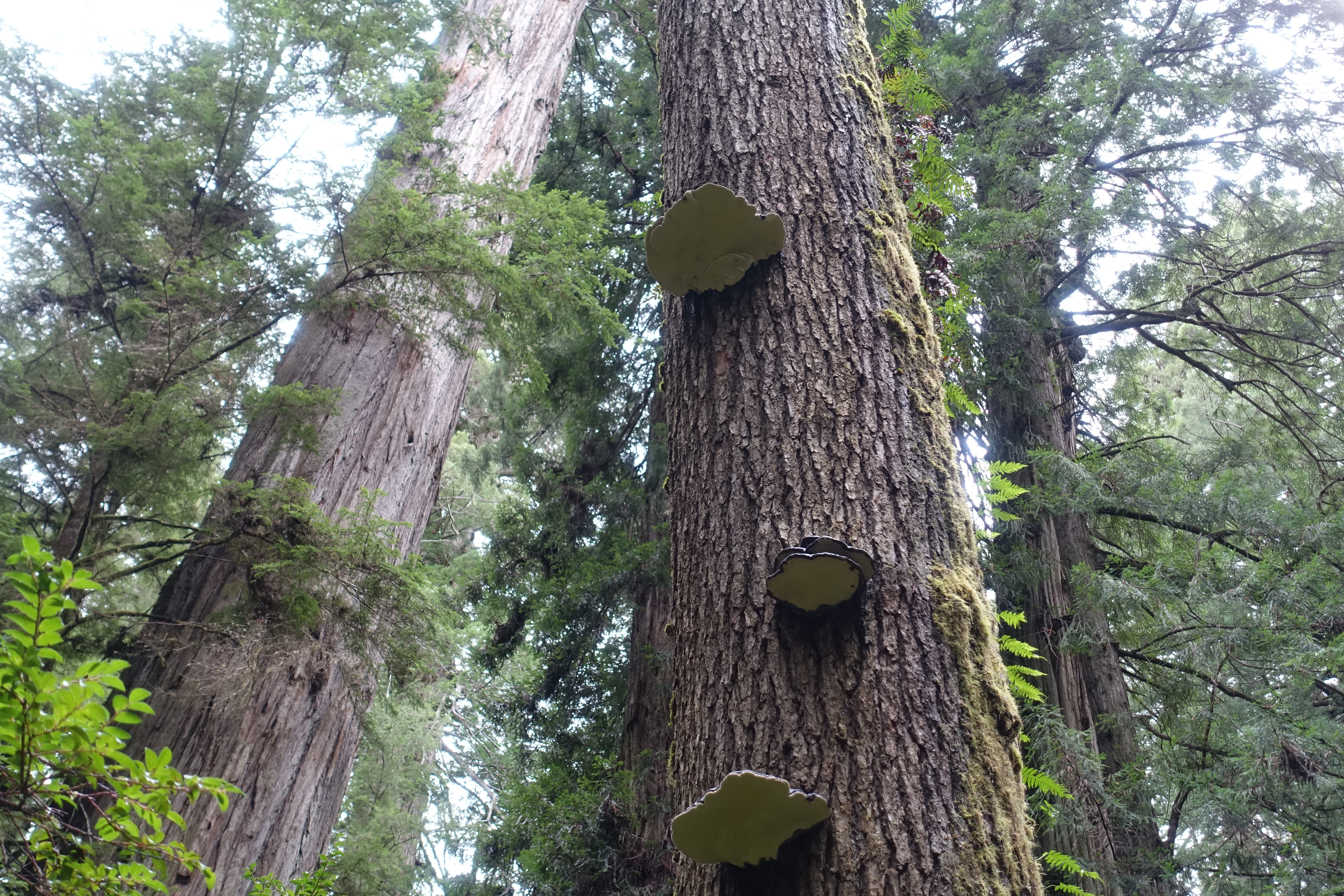
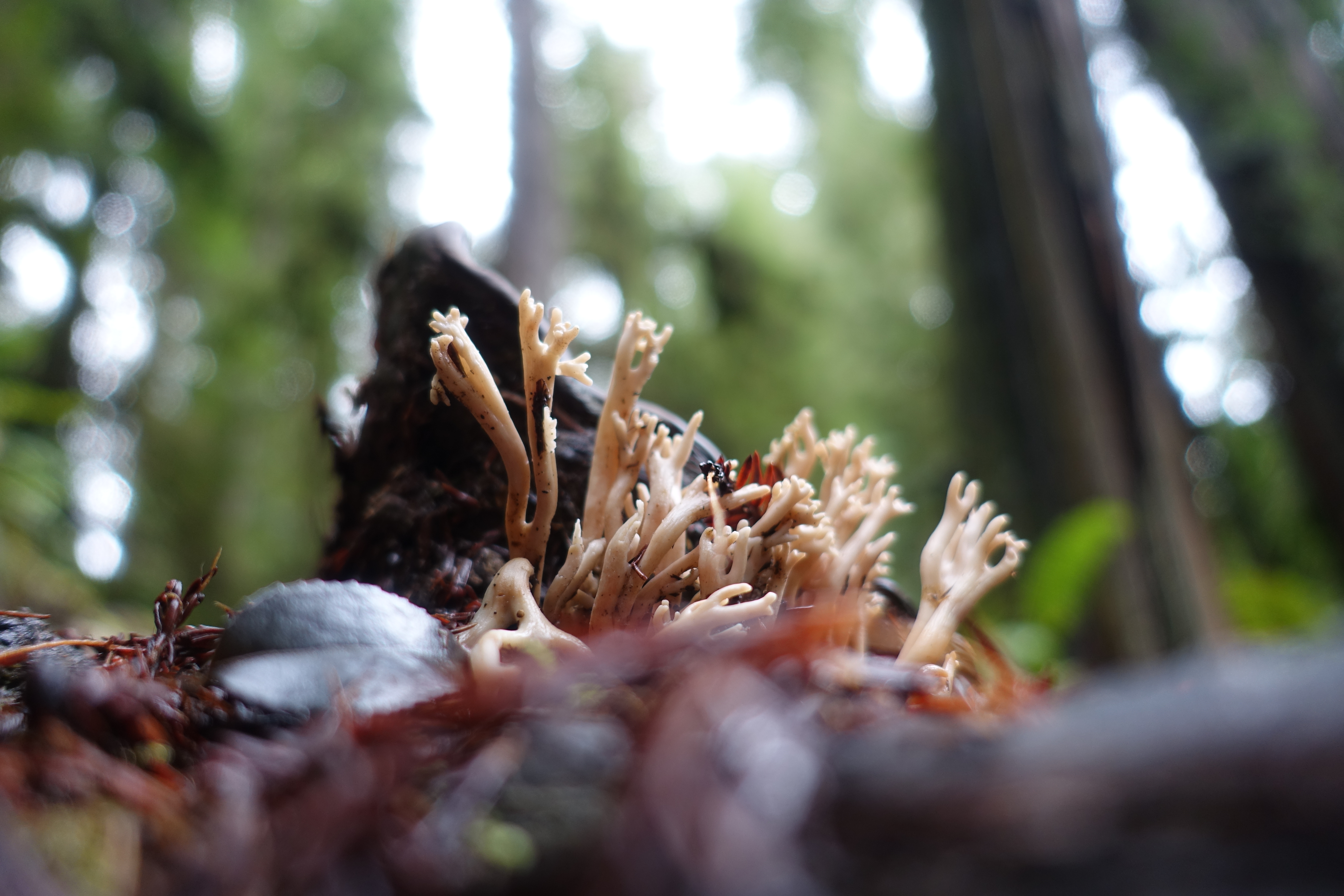
In addition to all of the green life – there was also a pleasant array of mushrooms to gander at along the trail if you could remember to look down instead of up at the beauty above. The vast amount of rainfall (averaging over 100 inches between November to May alone) creates the perfect environment (combined with the shade from the redwoods overhead) for mushroom growth. If you happen to know the species of the ‘shrooms pictured below – drop a comment or send me an email, as I always love to get to know more about the life in the places I’ve visited.


This trail, while only a few miles long, was one of my favorite hikes that I’ve done – even when comparing to places such as Sequoia and Giants Grove. Even though those southern forests have taller trees (General Sherman reaches over 300 feet), the overall amount of green in the Jedediah Woods Park felt more impressive. On top of that – we were once again mostly to ourselves in this off-season adventure, and only bumped into less than a handful of other hikers during the day.
We got ourselves back to Crescent City, and checked in for the night – we had an early morning as we would be setting out for a sunrise at the Natural Bridges back in Brookings, Oregon.

Thanks for a beautiful and well orchestrated video! Our son is in Portland for a short time and we are interested in going there in August this year. Your video and detailed travel plans are so inspiring! We used to travel this way with our kids, driving a few hours and stopping along the way enjoying new adventures with them, not always knowing what to expect. This was true of all different sorts of experiences, hiking, biking, coastal activities, caving, museums and zoos… Thanks for your encouragement to keep on keeping on!
LikeLike