
Overview
When most hear of the hike “Indian Head” – they quickly conjure thoughts of the Adirondack hike with spectacular mountain and valley views. But – there’s a lesser trafficked Indian Head in the Catskills, and some (okay myself) could say its as great (if not better) than its Adirondack counterpart. Ironically, when I first moved to New York, I heard about this famous “Indian Head” hike, and ventured to the Catskills rather than the Adirondacks. I was a little confused but pleasantly surprised when I didn’t find the exact views I had referenced online.
Indian Head in the Catskills rises to 3,573 feet above sea-level, and marks the spot as the easternmost mountaintop of the infamous ‘Devil’s Path’ Hike. Devil’s Path, a 24-mile, 6 mountaintop beast of a hike continually earns its spot as one of the most dangerous hikes in the world. Does one section of it – the Indian Head Mountain Loop – live up to the reputation of the Devil’s Path? Let’s see.
Location: Catskills State Park, Big Indian Wilderness – New York. Prediger Road Trailhead, accessed off of Plattekill Road (via route 23A)
Total Mileage: 7.7 miles
Elevation Gain: Approximately 1,700 ft.
Difficulty: Mostly moderate, with a few difficult descents through ledges, waterfalls and a bit of a chimney area. Some require using tree roots and narrow footholds. There are cliffs as well along stretches of the trail along the descent.
Seasonal Gear: MicroSpikes, Ice Axe, extra layers
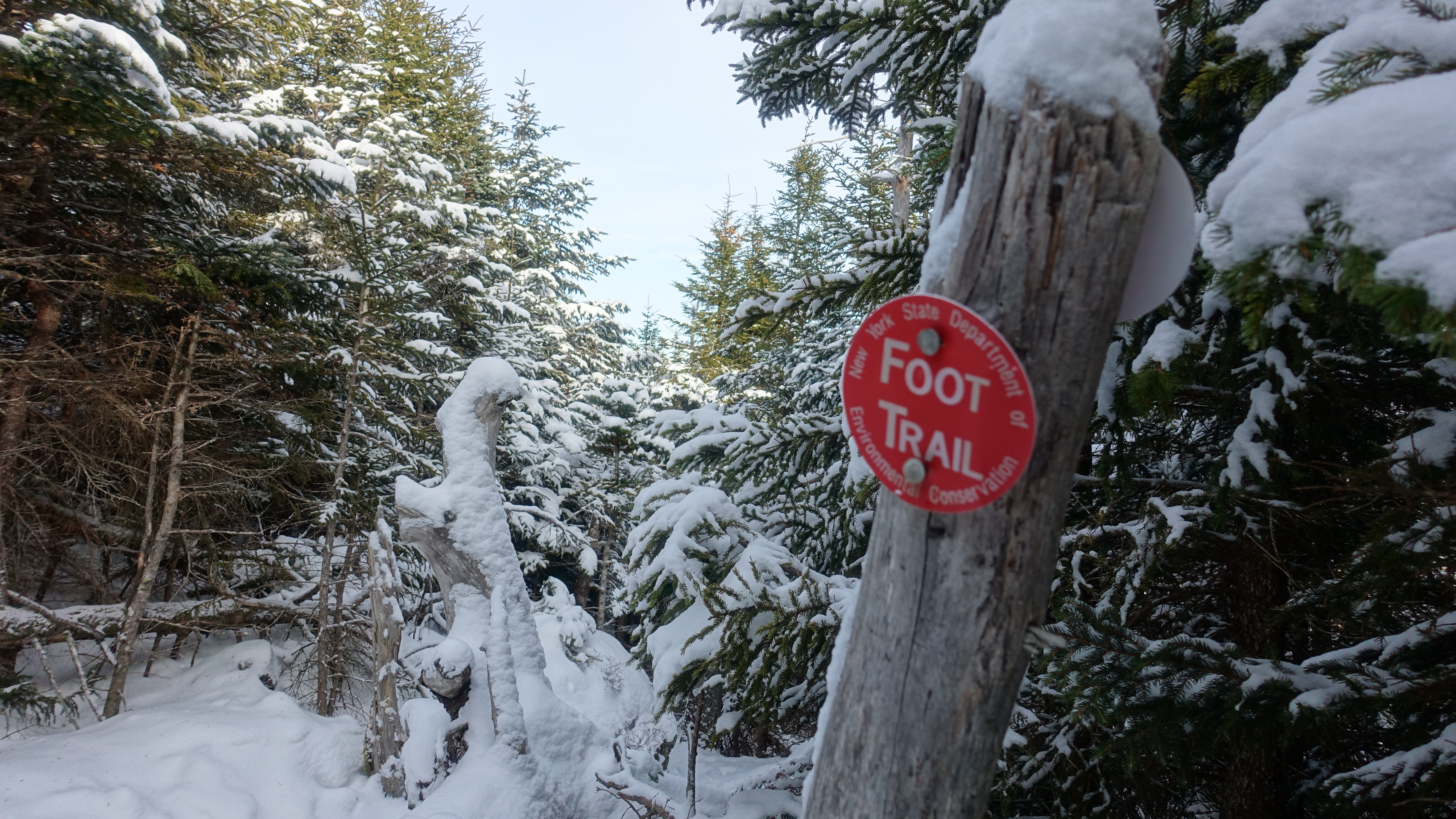
Trail Notes: During early December, likely to have a lot of blowdown, covering some sections of the trail. More trail markers are visible when doing loop clockwise versus counter clockwise.
Route: From the Predinger Road Trailhead, take the Blue Route counterclockwise to Jimmy Dolan Notch, then take Red to Indian Head Summit and back to trailhead
Crowd Factor: Hiked on a Thursday in December, only one other hiker seen during the day. Trail register indicated very few weekday hikers.
Detailed Review
The Ascent
Completing the trail counterclockwise resulted in the easier ascent versus a clockwise route, but made for a more cumbersome descent (detailed later). For the first mile and a half or so, its generally flat, with just a slight uptick in elevation.

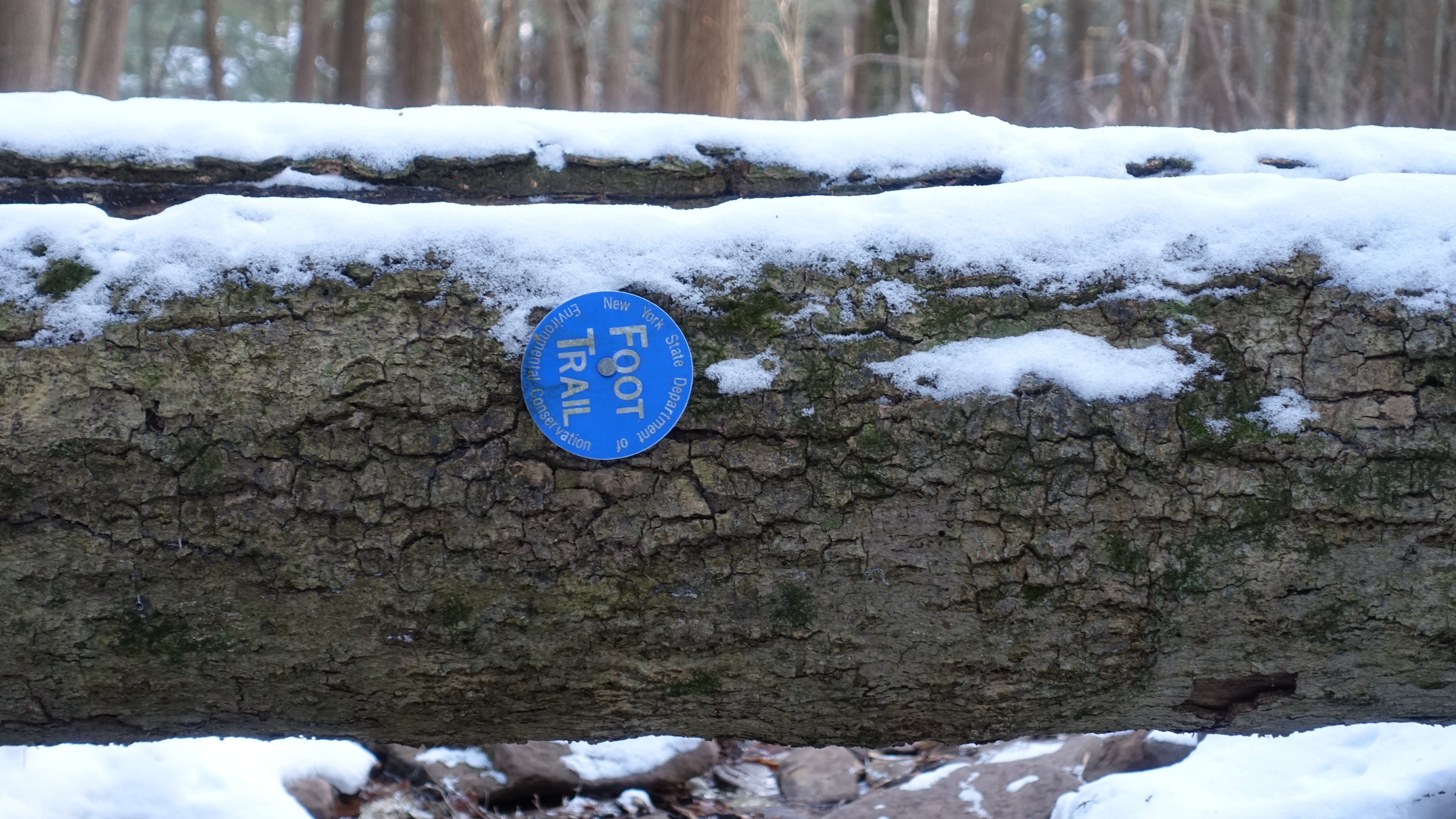
There are a few small streams to cross (which will obviously swell in the spring and after summer rains), which were not fully frozen during this mid-December traverse. The trail follows a number of stream beds, so you’ll be doing some rock hopping as you work your through. These will freeze over as winter moves on. Be weary and mindful of the fact that the trail isn’t incredibly well marked – some markers are very spaced out, and others are now on fallen trees or partially covered by snowfall. There were several times when making my way up where I had to spend an extra few moments to make sure that I had stayed on the trail.
Navigation difficulty aside, the rest of the trek up won’t challenge you too much. There are two sections of mildly steep elevation gain where you will likely break a sweat and stop for a few rests, but nothing technical yet.
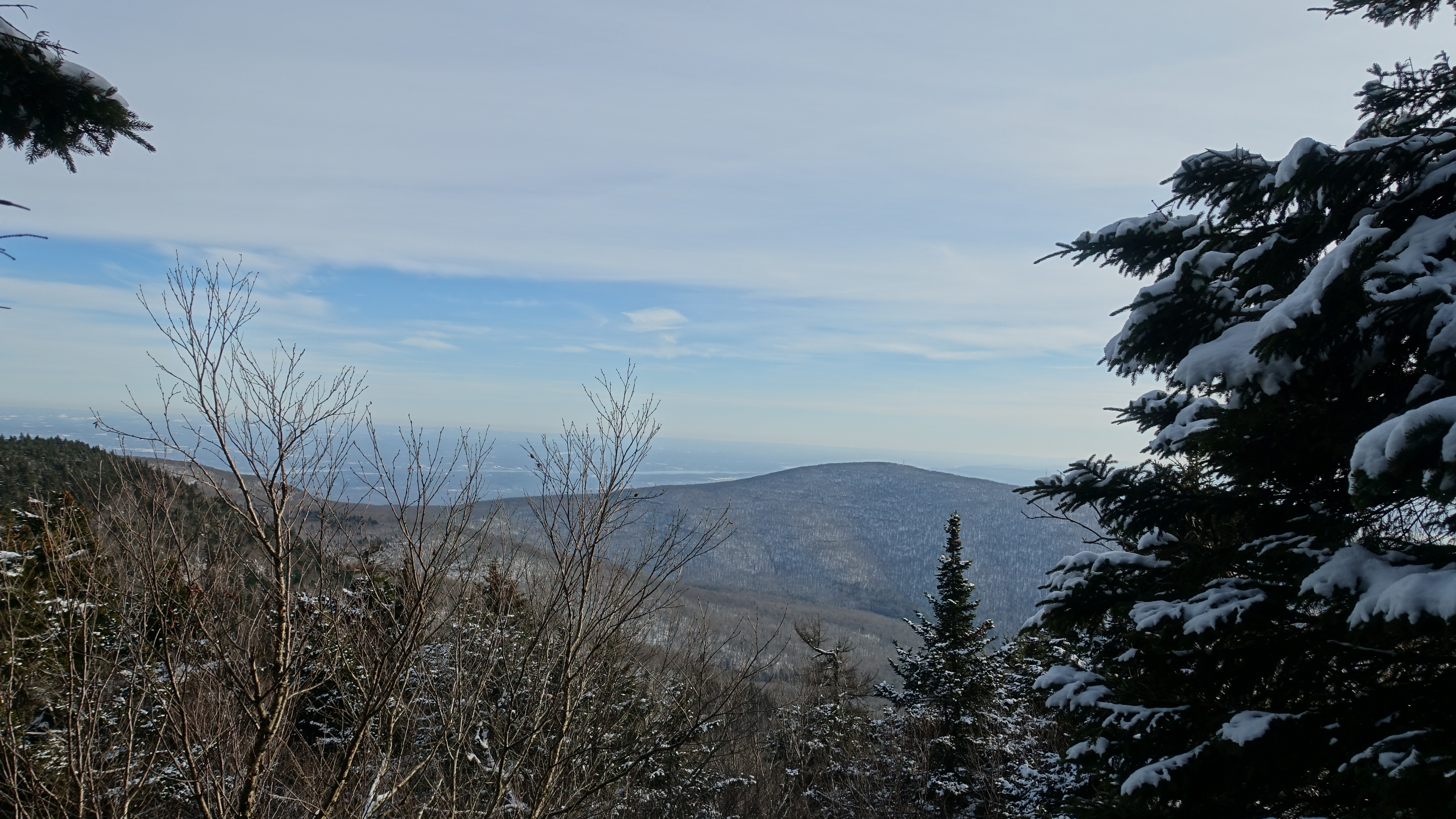
The trail continues in this manner up until you reach the trail junction at Jimmy Dolan Notch (the lowest point between Twin and Indian Head Mountains) – a ravine that you can work your way out and through to some views out into the valleys and southward towards Woodstock. In winter, the snow can be very deep through the notch, so avoid if you do not have proper deep snow gear.
From Jimmy Dolan Notch, you’ll have about 500 feet of elevation left to gain. About .2 miles in, you will come to the small crack/scramble shown below, which can be a little tricky to pull yourself up and through. To the right, you can use the tree roots as a handhold, or to the left you can try to squirm your way over the ledge, as its a bit too tall to step up from the ice building along the crack’s base.

After making your way through that, its mostly smooth sailing up to the summit, as you work your way through some beautiful evergreens likely coated in snow through most of the winter. Unfortunately, there aren’t many viewpoints from here to the Indian Head Summit (which itself is just a small clearing), but there’s a certain serenity to this part of the traverse.

The Summit
If you are looking for an expansive bald summit, you won’t find that on Indian Head. In reality, the actual summit doesn’t have any views – but you will find a decent little clearing just past the summit, with enough room to spread out and relax a little bit before beginning the descent.

The Descent (and Additional Viewpoints)
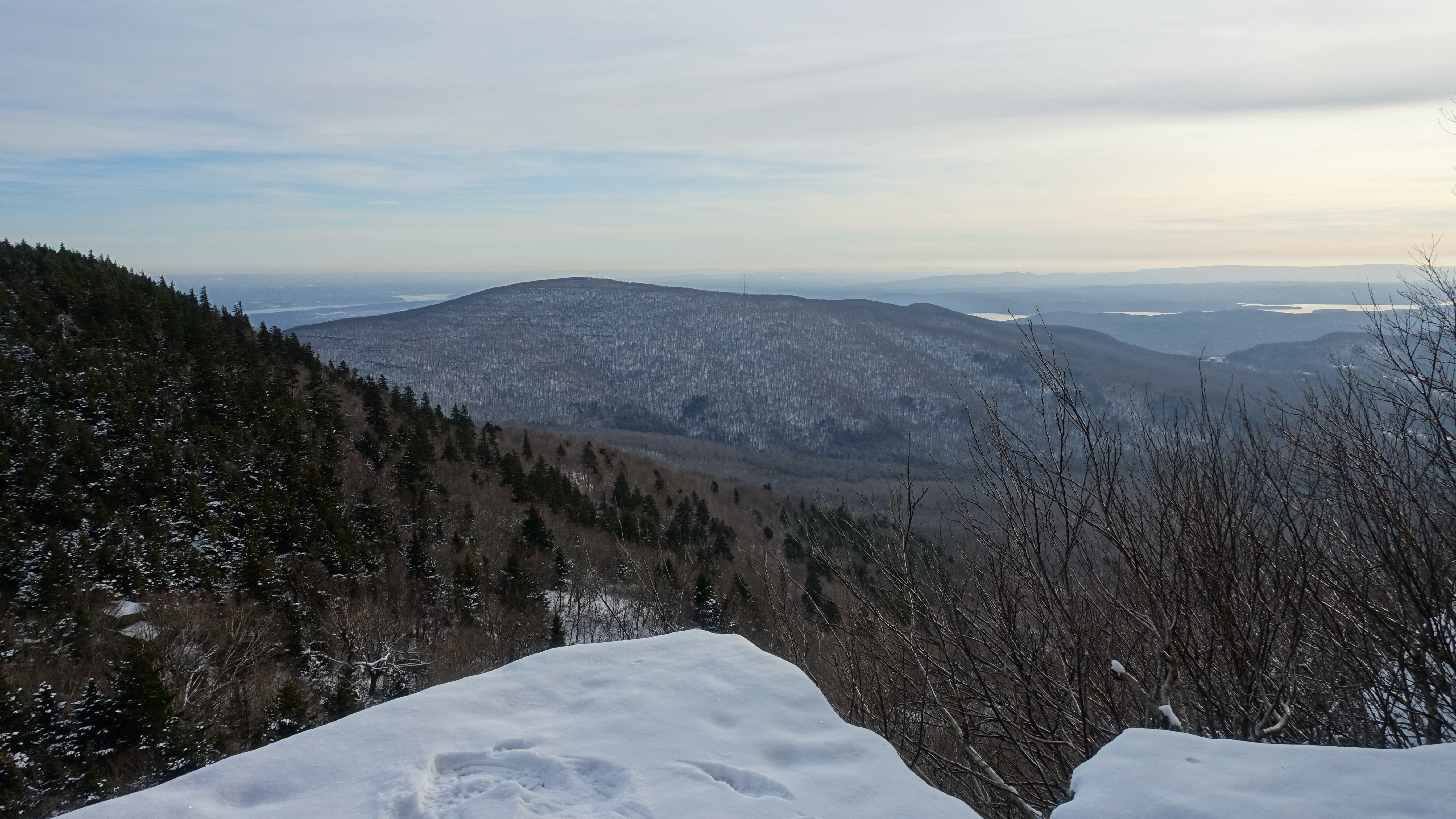
If you were disappointed by the lack of views from Indian Head’s summit – the viewpoints on your way down more than make up for it, but not without some of the challenging sections that live up to the Devil’s Path name. Had I not been working with limited daylight, I would have spent a nice chunk of time at each of them.
As you make your way past the view shown above, you’ll come into the first of the few challenging obstacles on your way down. Luckily, in early December, snow hadn’t accumulated enough yet to completely mask the features of the rock – so beware later in winter when the snow will inevitably be deeper.

Once you make your way down and through there – you’ll come to a section that I forgot to take a picture of – known as the Chimney Corkscrew. Its a crack of rock where you’ll need to use the tree roots to rotate around and come down, but its not too difficult. You may want to lower your backpack down ahead of yourself (I was able to get through with it on though).
Just past that, you come to a spot known as Sherman’s Outlook – which I think resembles a bit of an Indian Head itself – and the views here easily best the ones seen from the outlook just past the summit. If you can hold your hunger/don’t have a tradition of eating lunch at the summit, this makes for your best ‘lunch with a view’ spot during the hike.

Take some time to soak in these views, because afterwards, you have to make your way down and through the toughest section of both the descent, and the overall hike. Just to the right in these pictures lies a sheer cliff that you climb down using a system of tree roots and small ledges. I’ll have some of this part included in the video review (coming soon) so you can get a better idea of what you’re working with. Arguably, this section could be easier to ascend rather than descend, so consider doing this loop in the clockwise direction if you’d rather ascend it.


Once again, after the challenge of making it through that series of ledges and roots, you’ll be treated to some more viewpoints as you work your way back towards the junction, but also a steep cliff (seriously, like a 100ft. drop off) to the right side of the trail – so keep to the left when you feel the trail start to narrow and only a thin line of trees to your right.
Another interesting view offered along the trail is that of the Bruderhof Sect’s large community area and home. I had actually never heard of the place before, and thought it was a hotel at first (took some google searching to figure out what it was). It gave me a little bit of the Shining vibes.
After that, you’ll continue through more forest areas as you make your way to the next trail junction – going to the right will take you over to Echo Lake – go left to head back to Prediger Road. At this point in the hike, it was dark – and the really spaced at trail markers were a little tough to pick up at some points. Make sure to have a strong headlamp if you plan to hike any of this trail at night. While there wasn’t much elevation change, there were a lot of rocks to step over and around. This 1.4 mile stretch will bring you to the last junction, where you’ll head to the right down a mostly flat half mile section back to your car and the trailhead.
If you’d like to tackle the Indian Head Mountain Loop, but aren’t ready to go on your own (or would like the added benefit of a photography experience), consider scheduling a guided hike or inquiring about upcoming tours!

1 comment