
Overview
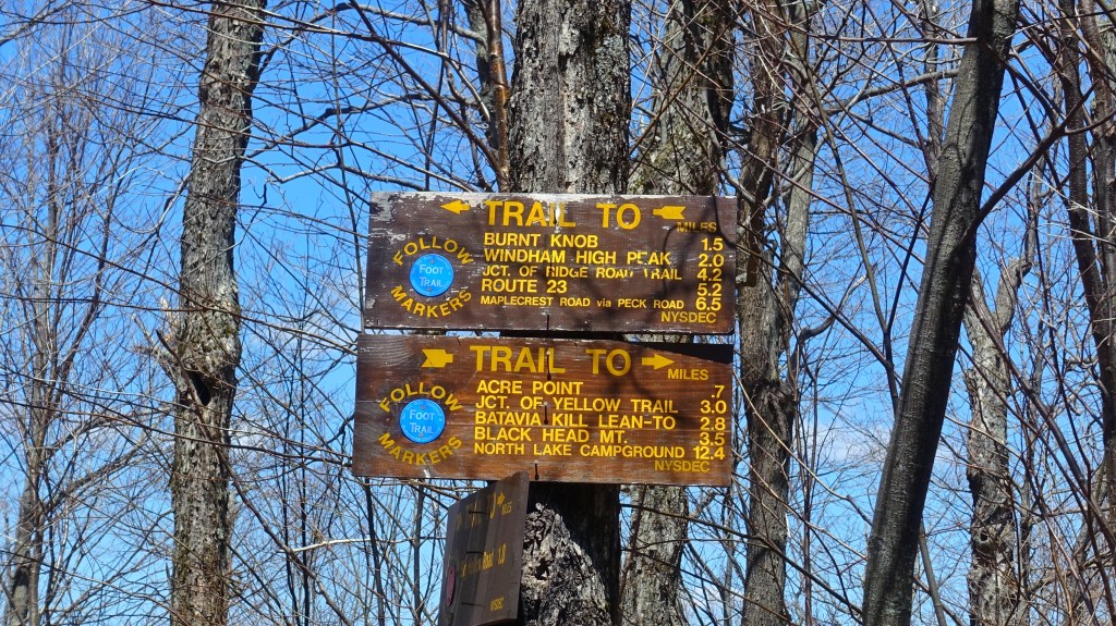
Sitting in the Northeast area of the Catskills Park, Acra Point is is a northeast-facing vista located along the famous escarpment trail – which takes you 25 miles from Windham to Haines Falls. For a taste of what the escarpment trail has to offer, going to Acra Point is a nice introduction. It also connects with nearby peaks including Black Dome, Black Head, Windham High Peak and North Mountain – so whether you do just Acra or continue on elsewhere, its a decent stop in the Catskills.
At just over a 3.5 mile round trip, Acra Point is a good option for beginners or those with children to take along. There aren’t too many challenging aspects, but the steady grade will keep the heart pumping as you gain over 1,000 feet in the 1.9 mile ascent. You start out along the light cascades of the Batavia Kill Creek before heading up and onto the Escarpment trail to Acra Point and the few little vistas nearby.
Details
- Distance: 3.8 Miles (out and back)
- Elevation Gain: 1,025 feet
- Difficulty: Easy, but strenuous
- Trail Markers to Follow: Red to Blue
- Crowd Factor: Medium. Expect some crowding near trailhead on the weekends, but the trails many other connections means hikers are well dispersed.
- Trailhead Location: Big Hollow Road Parking Lot, Maplecrest, NY 12454
Hike Breakdown
Trailhead to Blue (Escarpment) Trail
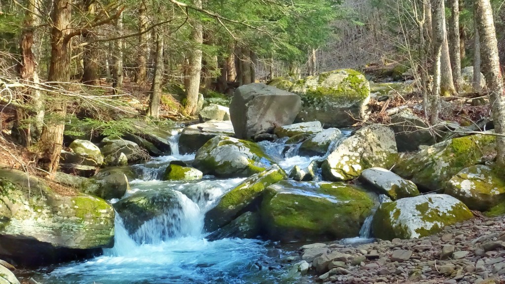
Once you’ve found a parking spot along Big Hollow Road (be sure to arrive early on the weekends), head to the Trail sign and follow the Red Markers to get on your way up to Acra Point. The trail is just a bit away from Batavia Kill Creek, which you’ll cross over as you begin your hike. For about the first .6 miles of the trail, you’ll then be zig-zagging across a small stream that as you gradually pick up a few hundred feet of elevation. I did this hike in early May, so the stream did have a few tricky spots – which would likely be the case after a hard rain as well.

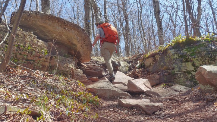
A little after .7 miles you’ll break away from the stream and start heading up a little steeper grade before the junction with the Blue (Escarpment Trail). At 1.1 miles in, you’ll have gained about 500 feet of elevation – but now is when you’ll start to get your workout. Especially if you continue on to one of the many other nearby trails.
Escarpment to Acra Point
Again, nothing technically challenging stands between you and Acra Point, but the grade is steep and steady until you level off at just over 3,000 feet of elevation. Unfortunately, even in early May there wasn’t much blooming above 2,000 feet – but you can imagine how green this section of the hike is during the summer months. You’ll wind through some interesting boulder formations as well – especially layers of sedimentary rock protruding from the sides of the mountain.
Below, you can really see the formation of the layers in the rock. Note the angle of the striations – which means that this rock has been shifted from where it was originally formed, when the lines would have been perfectly horizontal. Its always interesting to try and deduce how the rocks got to their current locations.


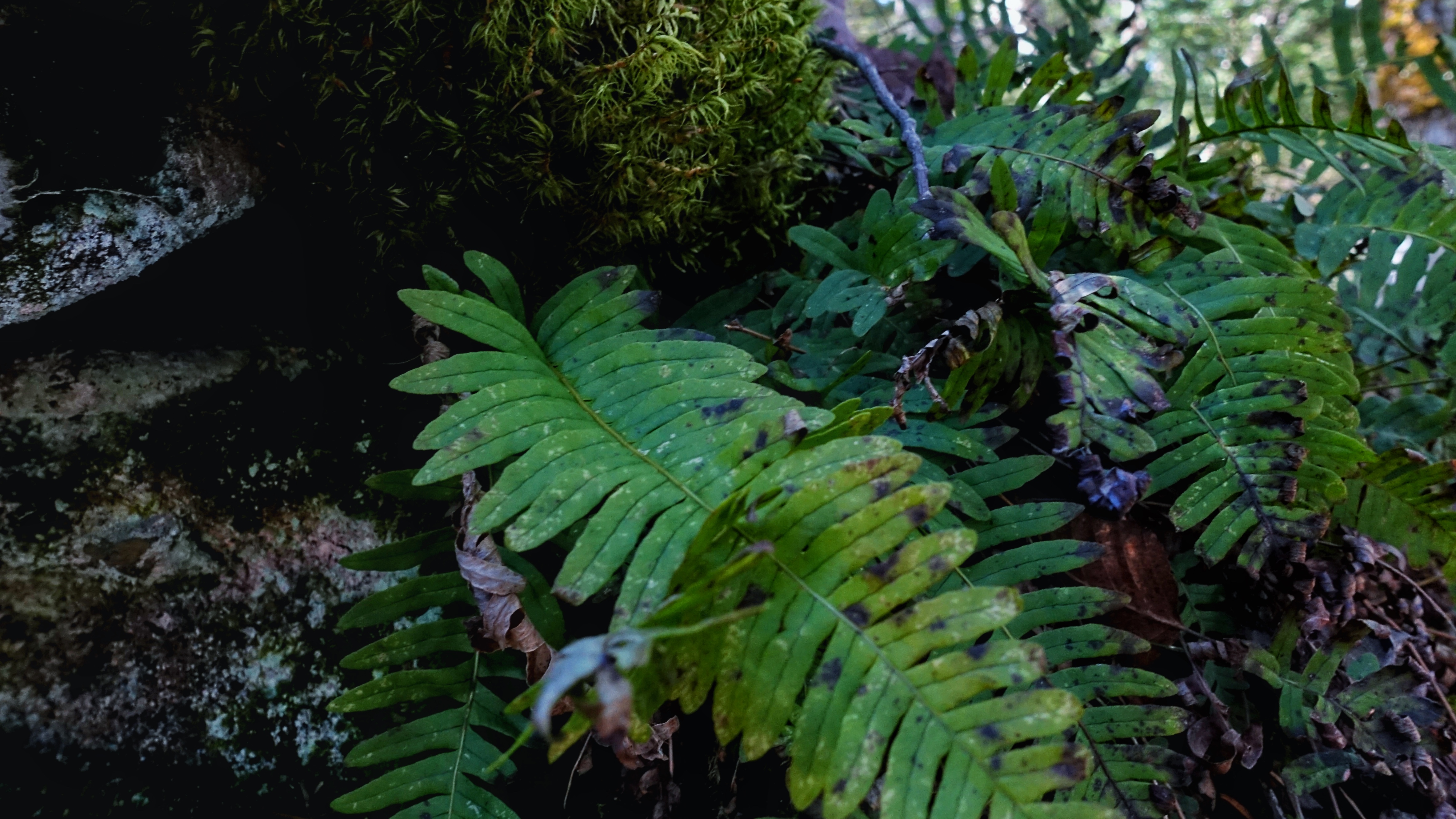
After stepping your way up and through and nearing 3,000 feet, you will level off onto easier terrain – and a lot more green It was almost like stepping back into a forest (thanks to the firs, moss and ferns) as you gained the last bit of elevation before arriving at the main viewpoint.

Acra Point
After 1.9 miles and 1,000 feet of elevation gain, you’ll see a small clearing to your right on the trail – while this is not technically the exact coordinate of Acra Point (to my knowledge) – it is the better view in the general area. It faces south and gives you a great view of the Windham-Blackhead Range. A little farther up the trail, there is a boulder that faces north out towards the lowlands and the much smaller Helderberg Range.
Head Down or Continue On
And there you have it – the hike to Acra Point is a quick one that is not too technically challenging, but is a good workout if done quickly thanks to the steady grade and quick gains in elevation. From there, you can retrace your steps back to Big Hollow Road, or continue on to Blackhead Mountain (and more) on your next Catskills Adventure.
If you’re new to hiking and not quite ready to get out their on your own – consider joining on a Guided Hiking Adventure with Roulette Travel!

1 comment