Overview
This is one of the most popular hikes in the Catskills Park, as the views from Giant Ledge span across the Catskills and are awe inspiring during any season, and that’s before you even get to the summit of Panther Mountain. However – these views also attract the crowds, so I would recommend going mid-week (if possible) or getting an early start on the weekends.
The roughly 6.5 mile out and back trail is mostly easy with just a few moderate obstacles as you gain just under 2,000 feet to Panther’s 3,705 foot summit. Or, you can cut the hike a bit short (if you’re not comfortable with the slightly more challenging terrain to Panther’s summit), and it will be about a 3.2 mile round trip – many choose to do this, as the views from Panther just don’t compare to those from the ledges. This review was done during late February, but you can expect to need microspikes when doing this hike anytime between November and May.
Details
- Distance: 6.5 miles
- Elevation Gain: 1,981 feet
- Trail Markers to Follow: Yellow to Blue (Panther Summit)
- Difficulty: Mostly easy from trailhead to the Giant Ledge, but will transition to moderate as you head up to the summit of Panther Mountain. If you are newer to hiking, I wouldn’t recommend heading up Panther Mountain alone – consider joining along with a guided hike!
- Crowd Factor: BUSY! Expect potentially dense crowds and limited parking Fridays through the weekend
- Trailhead Location: Giant Ledge Trailhead, Oliverea Road, Phoenicia NY
Hike Breakdown
For the sake of those looking to just do Giant Ledge rather than the full trip to Panther Mountain, I’ve broken up the hike below.
Trailhead to Giant Ledge
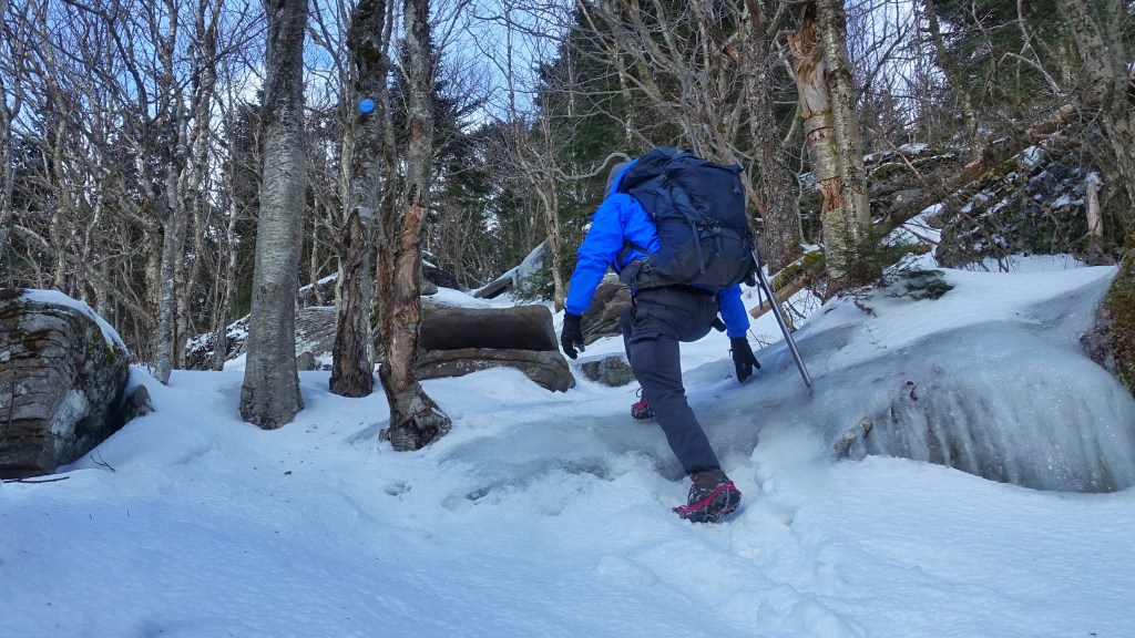
The first .7 miles of the Yellow Trail picks up about 600 feet of elevation as you move through the forest and then start to make your way up a gradual incline and through a few rocky scrambles and slides towards the junction with blue trail. As this review was done in February and New York’s 2019 winter temperatures were erratic, there was a lot of ice on the trail.

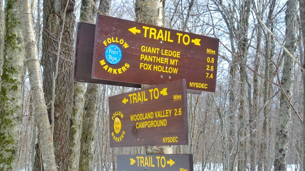
At .7 miles, you’ll come to the junction with the Blue Trail to Giant Ledge. Head to the left, and remember that you’ll pass this on your down – be sure to heed back to the correct parking lot when doing so.
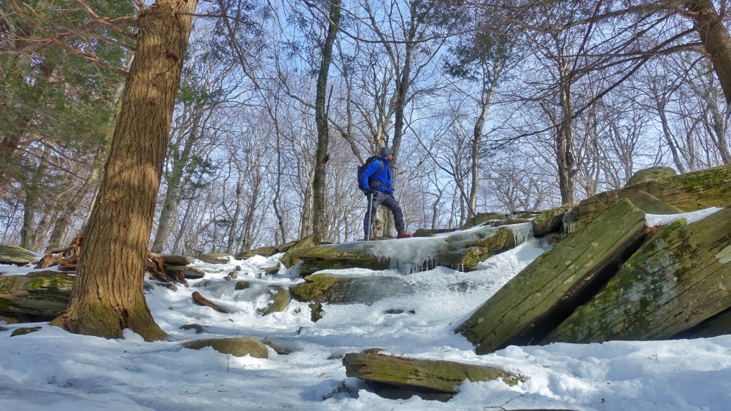
Once you get onto the Blue Trail, some of the terrain gets a bit tricky as you gain another ~400 feet of elevation on the way to the ledges. You will have a bad time if you attempt these spots in the winter without spikes, but in the summer, it shouldn’t pose too much of a challenge other than getting the heart rate up a bit. I brought my ice axe to help my knees on the descent, but trekking poles would have worked as well.

You’ll continue to gain elevation as you work your way up to the first of the views from Giant Ledge. The picture below shows one of the trickier little rock slides you’ll need to get up and through, but after that, its mostly smooth sailing. Again, this is mostly tricky due to the ice, so not really much to worry about in the warmer months.
Giant Ledge
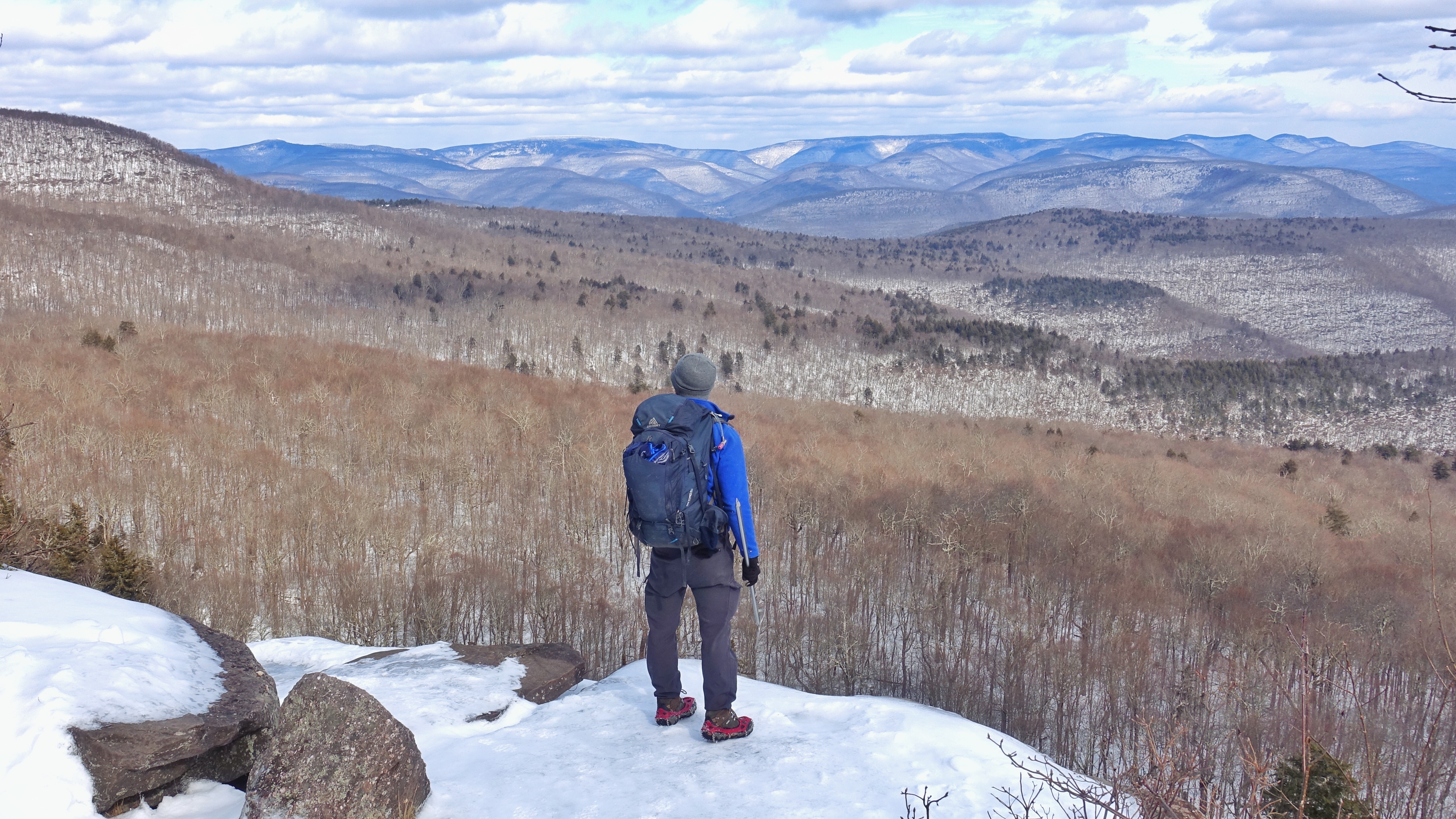
After about 1.5 miles, you’ll get to one of the first views from the ledge – looking east out over the Catskills. Its easily one of my favorite views in the Catskills – and it almost feels like you are out on the edge of the world. There are also two campsites available a bit back from the ledges – but with how popular this hike is, it wouldn’t be one of the places I would like to camp – but to each their own!
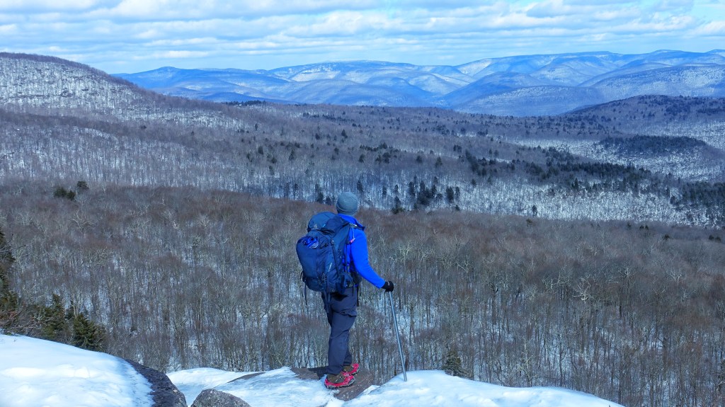
And then you can continue down the ledge, taking in the slightly different, yet pretty much the same view from the different ledge viewpoints. This feature helps to spread out some of the crowds on busier weekends so that you can still feel some peace and not feel crowded into a single spot like a bunch of sardines.

By the time you get to the third outlook, it will all look pretty much the same from there – so, take some time and enjoy the views and either call it a day (for about a 3.6 mile roundtrip), or continue on (and continue reading below) to head up to the summit of Panther Mountain.

Giant Ledge to Panther Mountain
After you take in the views from the 5 different viewpoints along Giant Ledge, keep heading North along the Blue Trail towards Panther Mountain. The summit sits 3,720 feet above sea level (making it the 18th tallest peak in the Catskills)- but the more interesting little factoid is that geologists believe that Panther Mountain is actually the edge of a meteor’s impact crater. Keep in mind, that the views from Giant Ledge are far more impressive than what you’ll see from Panther’s summit. From the Ledge, you’ll actually descend about 200 feet in the col before working your way back up the southern side of Panther Mountain.
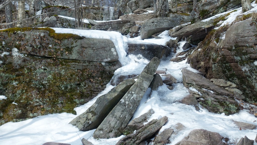
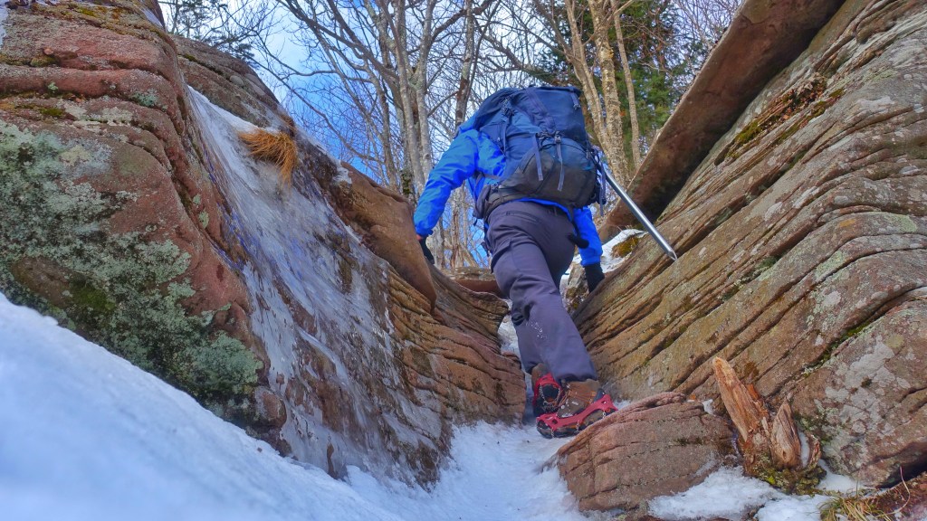
After you drop back down to about 3,000 feet in the Col, you’ll quickly start to pick up elevation as you work your way through some rock slides (and ice flows during the winter). Ice made a few of these sections challenging, and near impossible without microspikes.

There’s even one neat little crack to get yourself up and through before you start to approach the summit. Luckily in the one shown below, the snow pack helped with getting up and through without too much trouble.
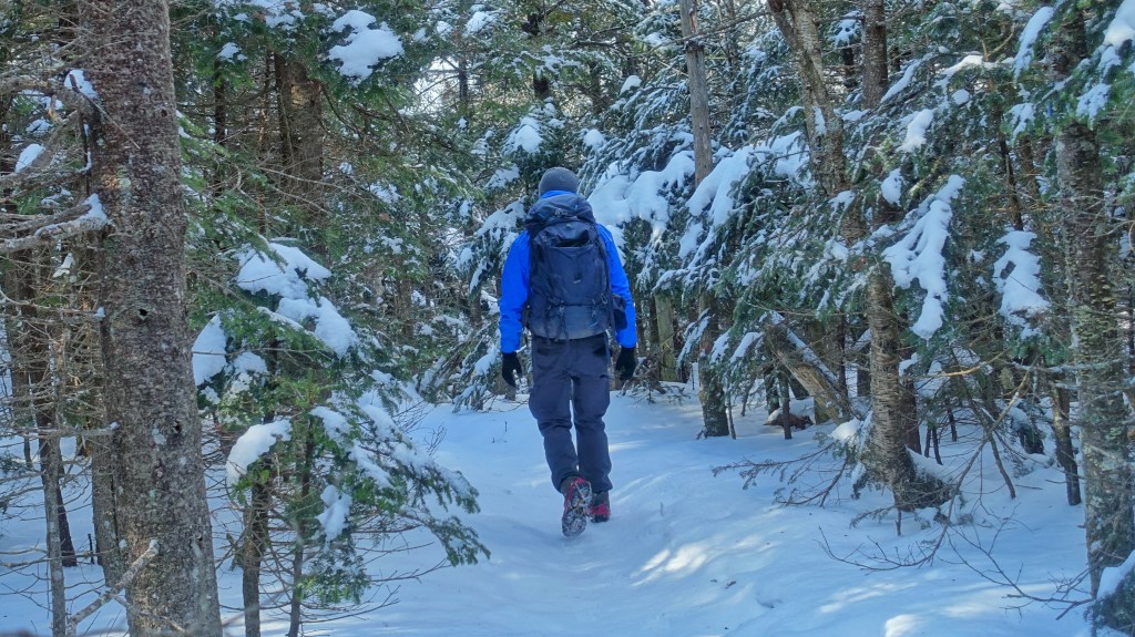
The last third of a mile tapers off as you pass through groves of pine – including some balsam fir – a beautiful site in the winter after recent snowfall as seen here. From here, you’ll start to see the sky above you as your work your way to the small clearing that marks the summit.
Panther Mountain Summit
After approximately 3.6 miles, you’ll have worked your way to the 3,715 foot summit of Panther Mountain. While it pales in comparison to bald summits such as Twin Mountain, its a Catskill Summit nonetheless. This also means that Panther Mountain can be a quieter hike on busier weekends (once you’re past Giant Ledge of course).

There is actually a little better of a viewpoint just before the summit, which you’ll either stop at before or on your way back out. There’s a little bit more of a clearing once you climb up and out. I spent more time here than I did at the actual summit, and you likely will too. Don’t mind the horrible framing on the picture below – if you’ve got a tripod or another person with you, there’s a great photo opportunity.

From there, head on back down Panther Mountain, through Giant Ledge, and follow the trail signage back to Oliverea Road. To join on an upcoming hike to this summit or others in the Catskills, visit Roulette-Travel.com/GuidedHiking!
