Overview
Blackhead Mountain is the 5th highest peak in the Catskill Mountains of Upstate New York, and its ascent via the northern side is one of the more difficult high peaks that I have come across. The lure of this peak is in the difficulty of the ascent, since the 3,940′ summit is within a pine grove – but there are a few great viewpoints before and after the actual summit. Below, its easy to see how the Blackhead Mountain earned its name – during the winter and spring, the evergreens along the summit ridge are a stark contrast to the barren trees below.
At one point on the ascent, I even considered turning back due to the amount of ice still on the trail – in early May. And that was after a particularly dry winter. Due to the extensive shade from evergreen, as well as the trail’s north facing orientation means that this trail has winter conditions much later than other trails in the area. Be sure to carry microspikes in the shoulder months, and consider crampons during a winter ascent. Or, consider an out-and-back ascent from the south face, where ample sunlight melts away much of the ice earlier in the spring season.
Hike Details
- Distance: 7.8 Miles
- Elevation Gain: 2,093 feet
- Difficulty: Mostly moderate, transitions to hard
- Trail Markers to Follow:
- Trailhead > Red (Towards Acra Point) > Blue (Towards Acra Point/Blackhead) > Yellow (Towards Blackdome) > Red (Towards Big Hollow Road) > Return to Trailhead
- Crowd Factor: Medium due to Acra Point connection, but once you are on the way to Blackhead, not very busy. However, Trailhead Parking is limited, so plan to arrive early on the weekends.
- Trailhead Location: Big Hollow Road Parking Lot, Maplecrest, NY 12454
- Special Notes: Winter conditions into May. Microspikes recommended through May.
Hike Breakdown
Since the beginning of this hike (from the Trailhead to Acra Point) was already detailed here, I’ll briefly touch on that part and then move on to the Blackhead Ascent.
Trailhead to Acra Point


As a nice warmup before you get moving towards the Blackhead Summit, the trail to Acra Point will take you along a mountain stream on the way to the Escarpment Trail junction. You’ll see a steady grade over the 1.9 miles and 1,000 feet of elevation on your way up to the vista that looks out over the Windham-Blackhead Range. Click here to read the full recap of Acra Point.
Acra Point to Blackhead Ascent
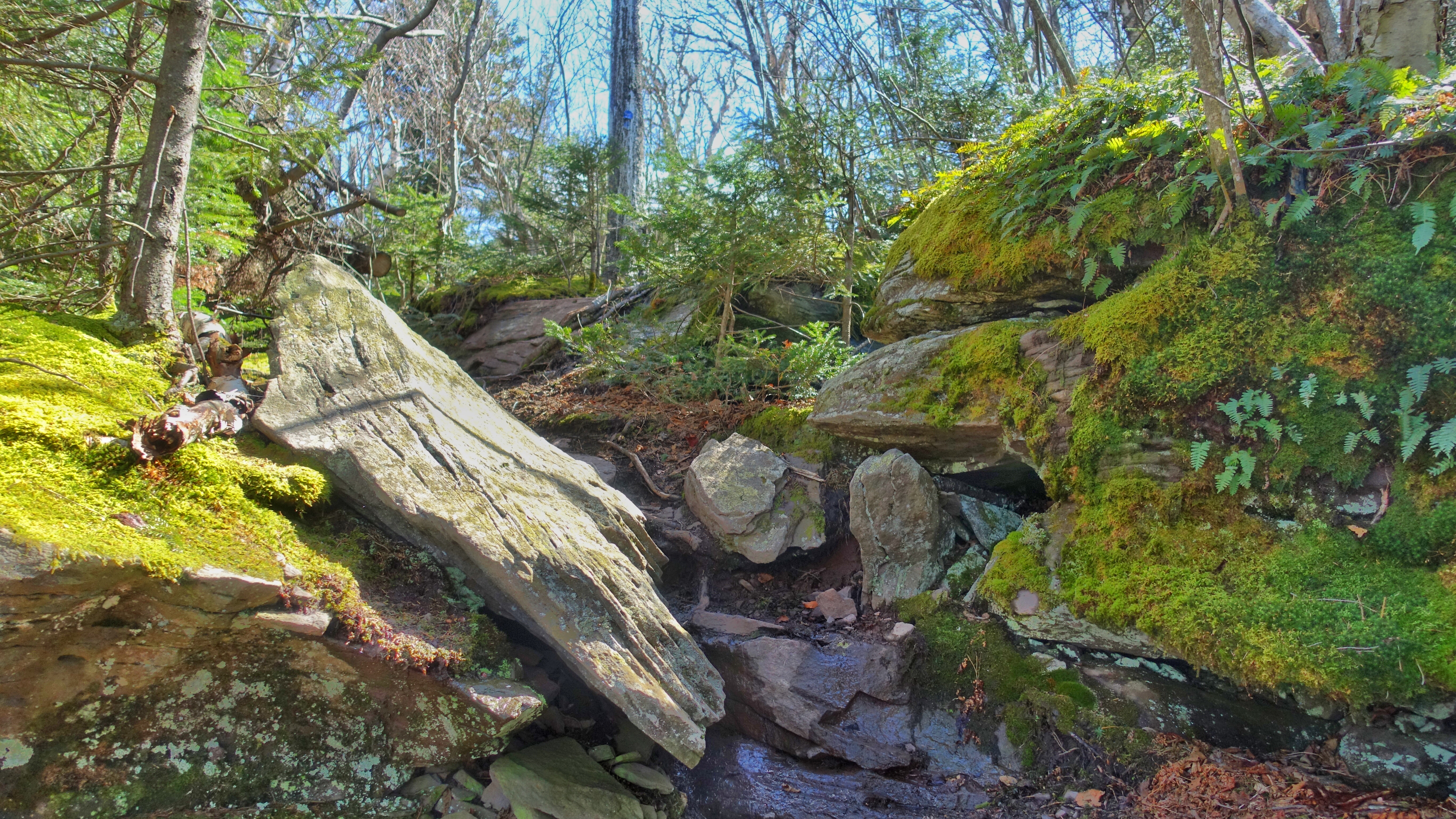
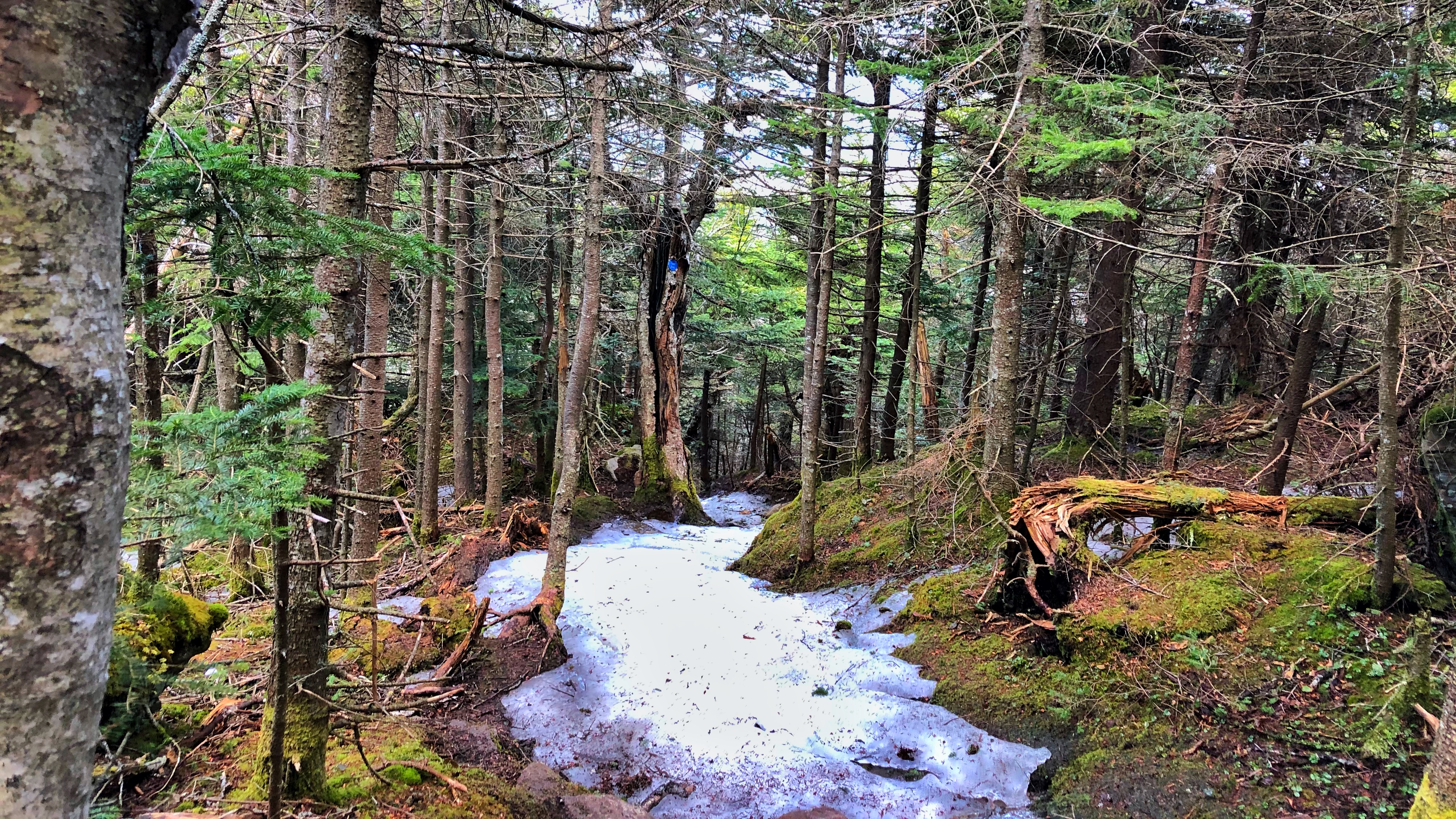
From Acra Point, you’ve got another 2 miles to go along the Blue (Escarpment) Trail before you get into the challenging ascent portion. You probably won’t pass many other hikers from here until the summit, as its not a particularly popular route. You’ll actually descend a bit into the col between Acra and Blackhead and lose about 200 feet of elevation in the process. Its a gradual drop with a few rock slides to keep it interesting.

There was a lot of blowdown on this section of the trail (likely due to exposure from winter winds from the North, as the escarpment is the northern edge of the Catskills), and a bit muddy as well. Remember to walk through the mud and not around it, as this damages the trail by gradually widening it. Also – be prepared for black flies, mosquitoes, and ticks when temperatures are warm.
Blackhead Ascent
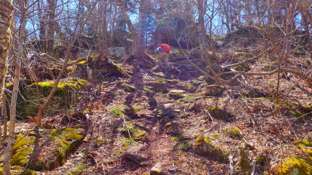
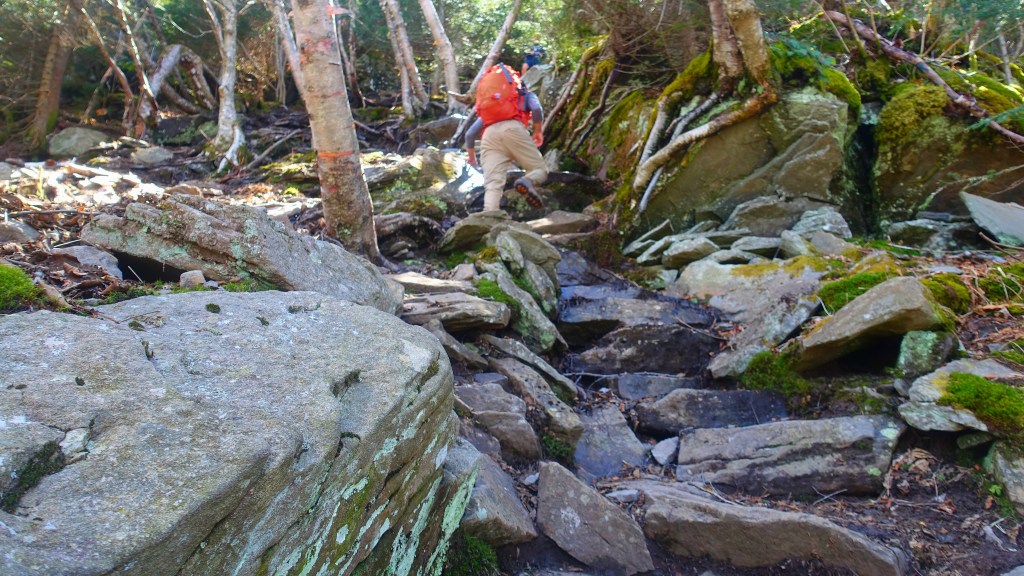
At about 3.6 miles in, you’ll come to the trail sign indicating that you’ve got .9 miles to get to the summit. From here, it does get quite difficult – you’ll need to use your hands, creative scrambling, and have good balance. Its a continually steep grade from here – you’ll gain over 1,100 feet of elevation in just .9 miles. As noted above, this was one of the most difficult ascents I’ve made in the Catskills.


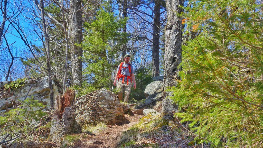
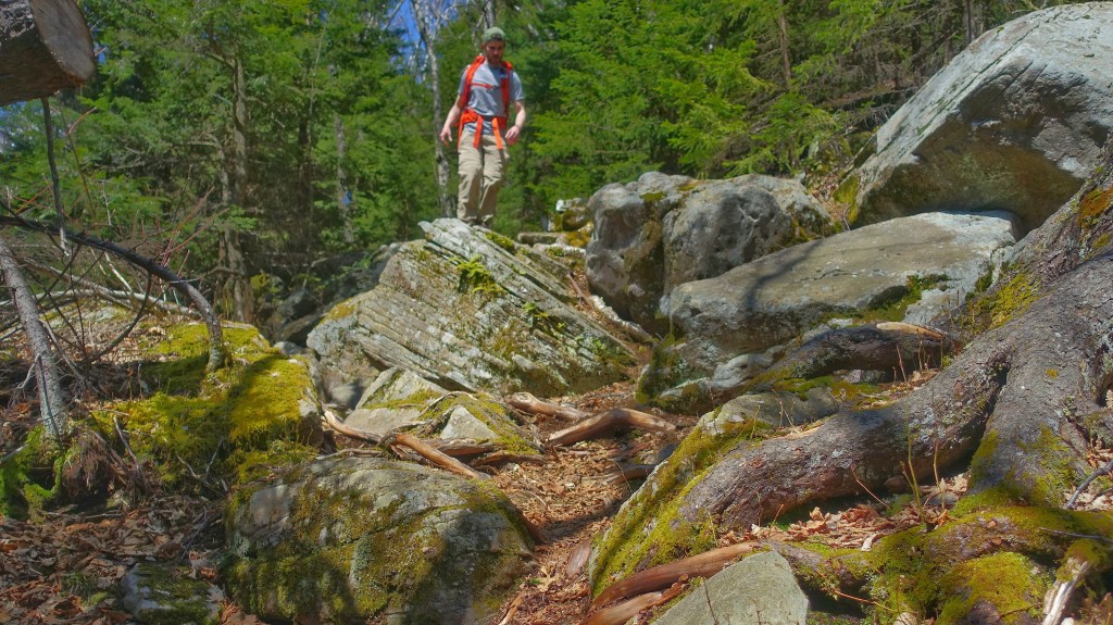
For the first third of a mile or so of the ascent, you’ll be heading up rocky inclines and stepping through small chutes and natural steps. The grade will start to increase as you transition from stepping up and over rocks, to walking between and through larger boulders and rock formations.
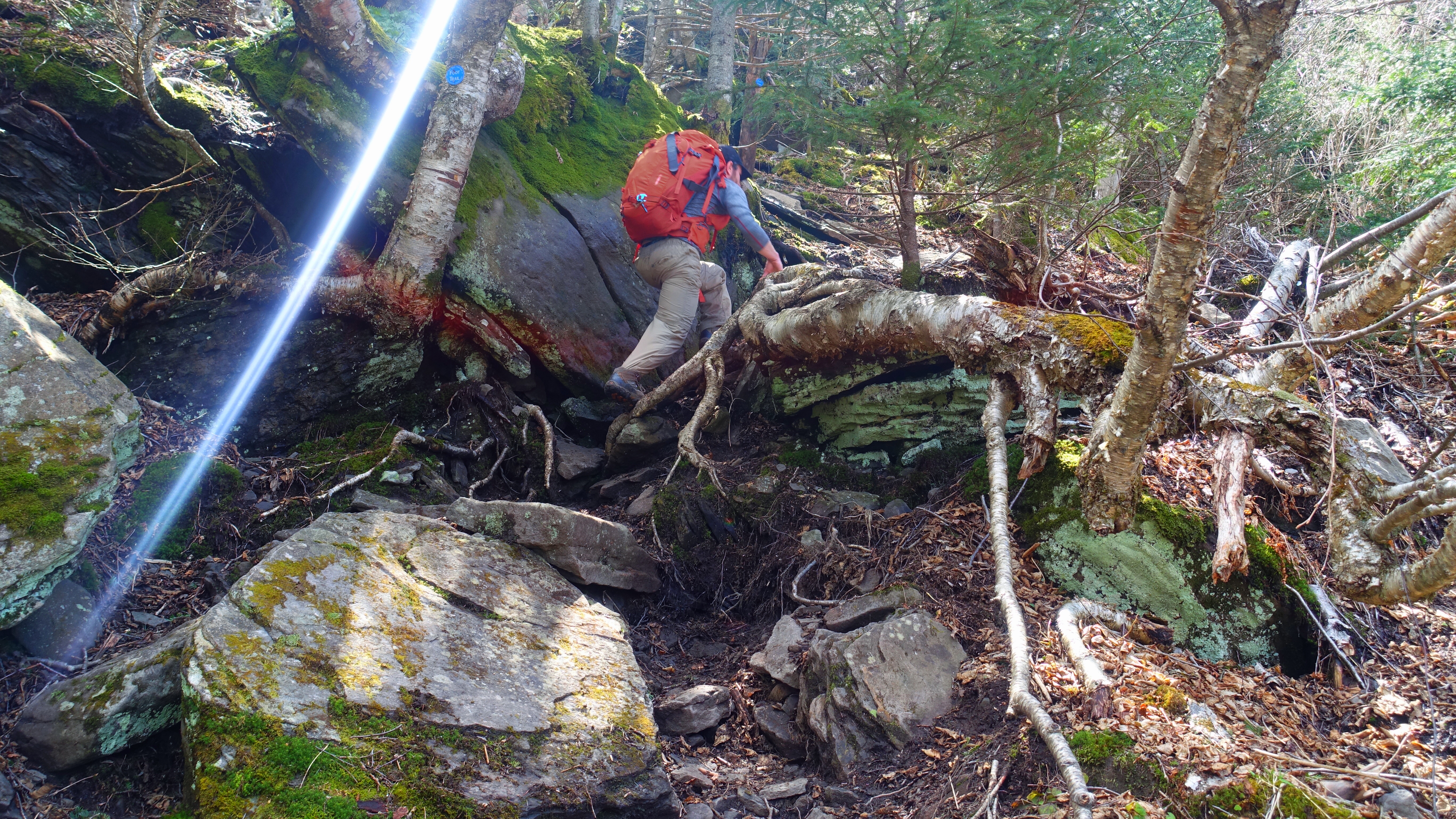
Due to some of the ice on the trail during my first run up to Blackhead in early May, I returned again to get pictures going through the obstacles with someone to help take pictures later in the season. Even by mid-may, there was still a little bit of ice left on the trail. Hence the changing hats and sleeves that change length between pictures!

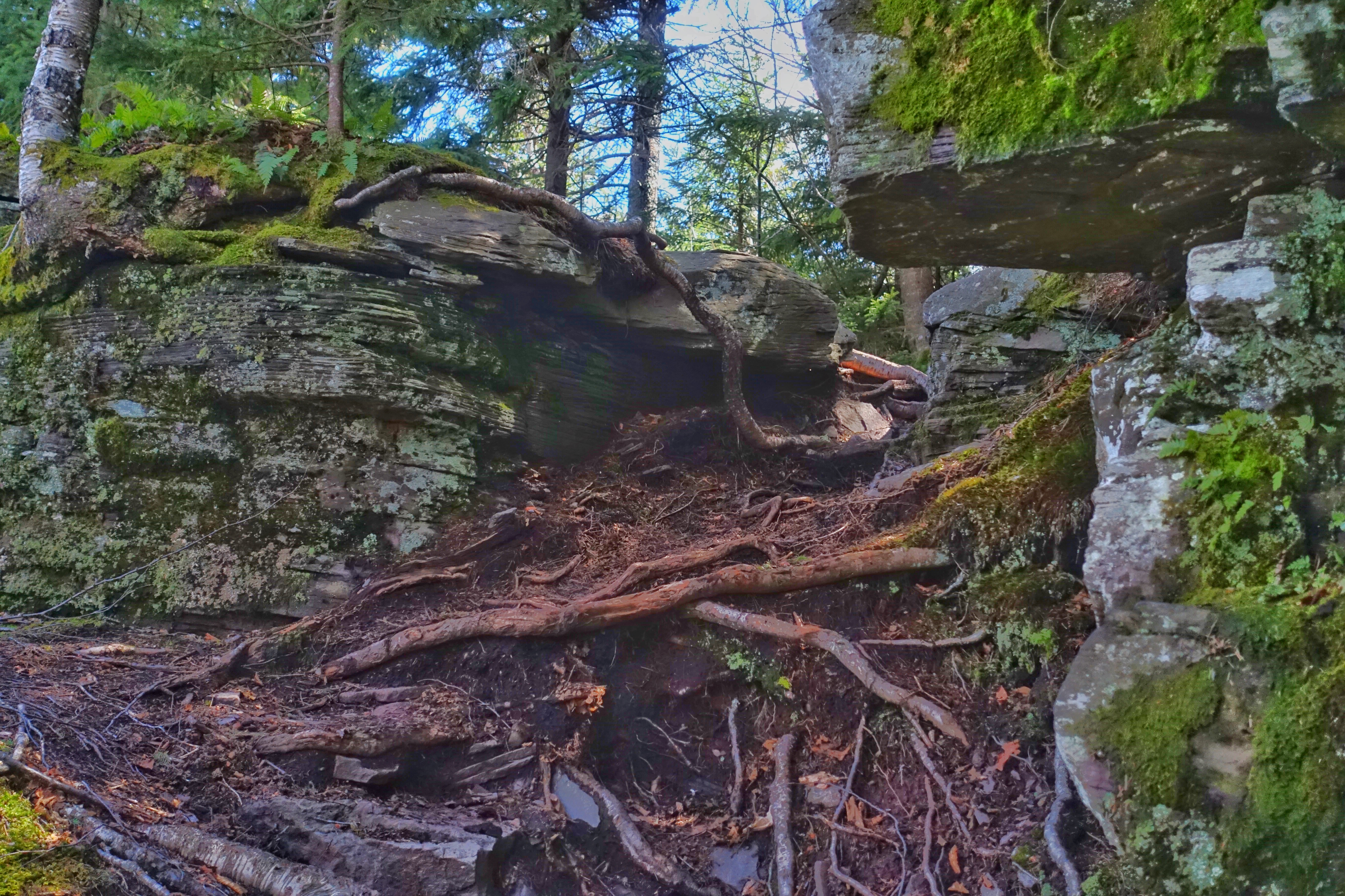

And then, once again, it starts to turn up the intensity a little bit as the terrain in front of you gets steeper and steeper. Below, you see my face as I notice one of the next obstacles along the trail, as well as the bits of ice farther up the trail.


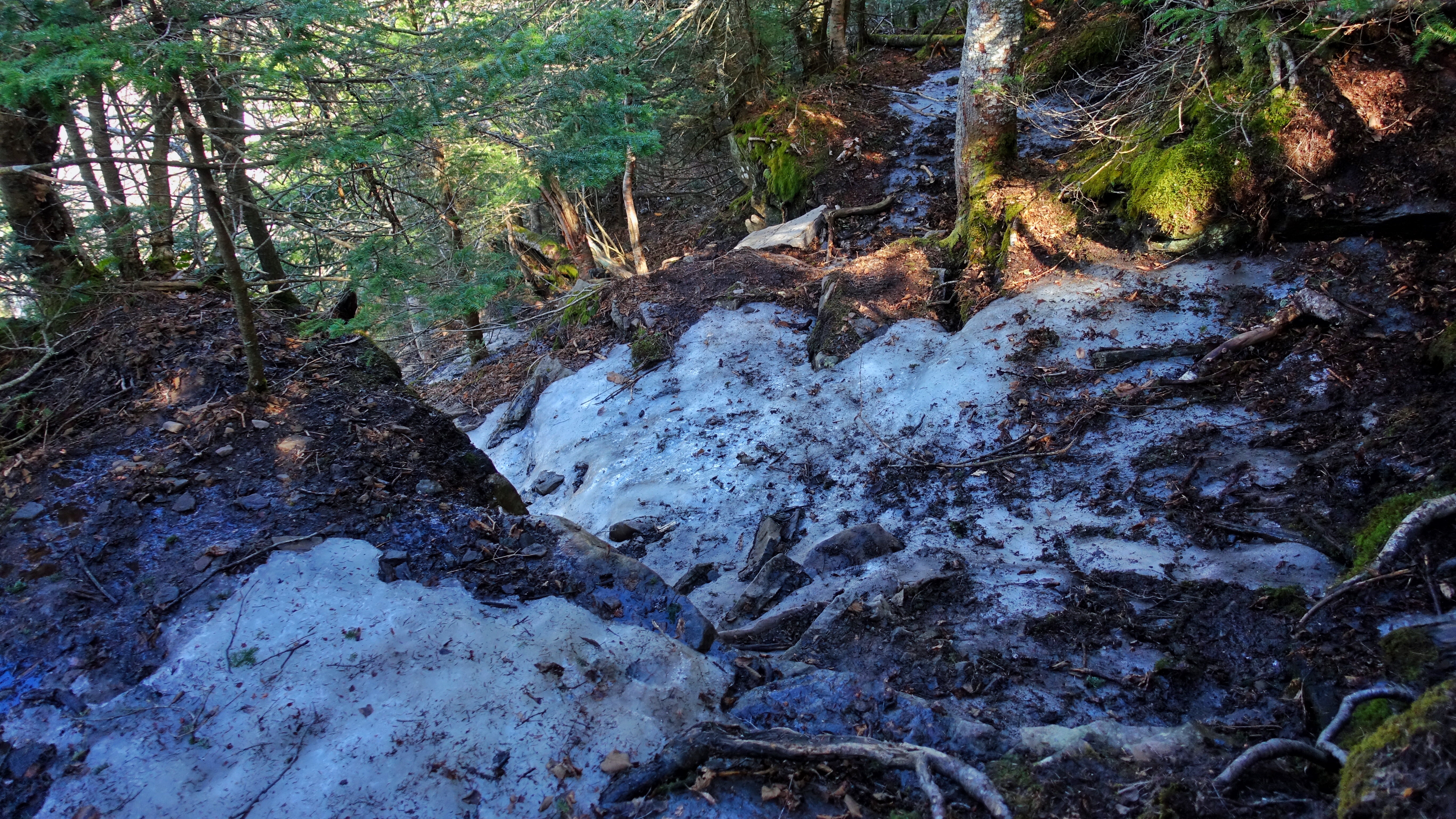
And then, when you get to about the last third of a mile to the summit of Blackhead, you’re likely to encounter some ice in the early and late shoulder seasons. Expect winter conditions on this hike later than many others in the Catskill Mountains. The melting ice flows covered much of the trail, and there were several sections in particular (shown below) that required very precise boot placement as well as the assistance from trees beside the trail. It was here that I contemplated turning back – but knowing that the descent would be even more cumbersome, I pushed on.


Once you’re through those steep and icy areas, you’ve got just a little bit of ways to go to the summit.
Take in some of the views along the way, because once you’re at the actual summit, the only view is of the sky above you.
Blackhead Mountain Summit


Ah – you’re now at the fifth tallest summit in the Catskill Mountains, at a lofty 3,940 feet above sea level. Even though there’s not much to see from there, like any peak you’ve just climbed, its still a great place to take it all in. The large boulder offers enough room for a few groups to relax, even when taking social distancing into account. Below, you can see just how deep into a sea of green the summit really is.
Since the views are nonexistant here, you’ll likely have the space to yourself. You can also divert to other hikes along the escarpment ridge which continues on for another 20 miles through the Catskills.
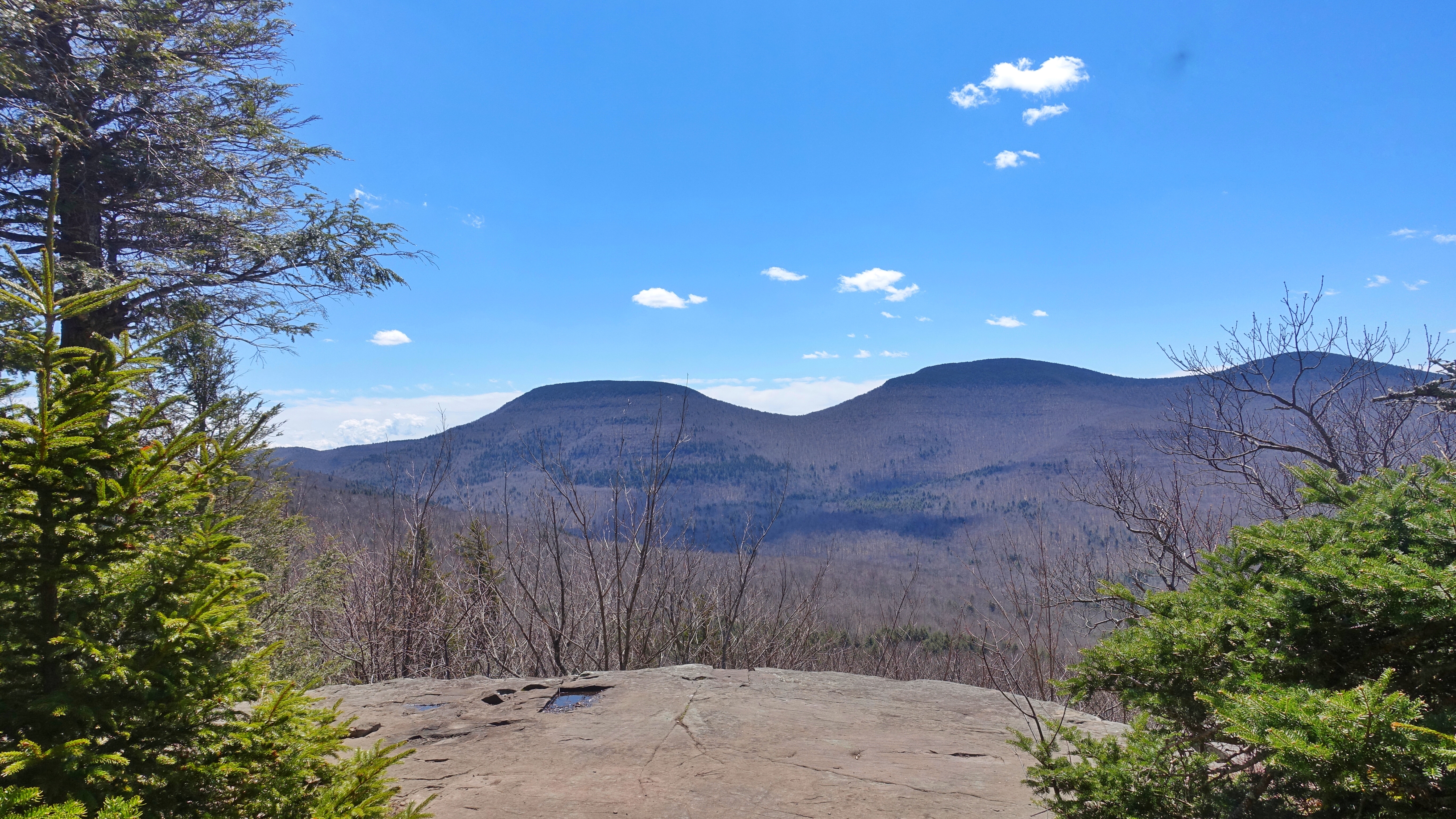
The Better Viewpoint
You could technically complete this trail as an out-and-back route, but descending back through the ice and missing out on the additional viewpoint with views of Blackdome would be hard to justify after working so hard to get up there. While coming down on the south side, it was like walking into a different season. Below, you can clearly see the outline of the trail as it winds down the southern side of Blackhead. You’ll have expansive views of Blackdome and the Devil’s Path in the far distance thanks to the much more open trail.


Its only 2.8 miles down the Black Dome Range (which you can summit for an additional 1.2 miles to the round trip), and then back to the Batavia Kill (Red) Trail that leads back to the parking lot at Big Hollow Road.

And then, just a pleasant downhill trek back to the parking lot, tracing next to streams with small cascading falls between large boulders. Just a stream to get back across, a bridge and you’re back to Big Hollow Road.

We hope you enjoyed this hike recap! If you’re curious about this trail but not quite ready to do it on your own, visit Roulette-Travel.com/guidedhiking for more information or to join on a guided hiking adventure!

1 comment